- Sport
Refuge de la Dent Parrachée
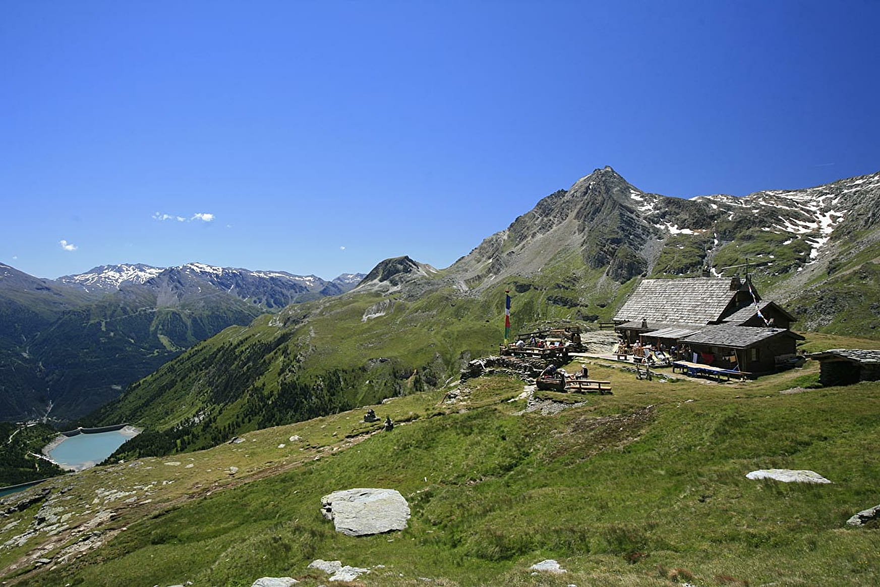
Hiking accessible to any walker with a panoramic view of the dams Plan d'Amont and Plan d'Aval, Dent Parrachée and other surrounding peaks.

About

Further informations
Ground
Possibility of access via chairlift Gran Jeu - go time: 1:30
Starting point: Parking dam of Upstream Plan
Elevation start: 2,050 m
Elevation tour: 2511 m
Reference Carto: IGN 3534 OT - The Three Valleys - Modane - Series Top 25 - Scale: 1/25000
Stroller accessibility: no
Type of land: land
Type of trail: trail maintained PNV
Level of the hike: walker, no problem
Markings: yellow panels PNV
Prices
Free access.
Reception
The duration of hiking trails is calculated using reference paces: 300 m/h ascent, 500 m/h descent and 4 km/h on the flat.
As hazards may occur at any time on the routes, the GPX tracks provided are not contractual. They are given for information only. Riders use them at their own risk, depending on their level of technological proficiency and their understanding of the terrain.
Period of practice
From 15/06 to 30/09.
Subject to favorable snow and weather conditions.
- Accessible via ski lift
- Car park
Contacts
Access
Access by road from the dams. From Aussois, head towards the Plan d'Aval and Plan d'Amont dams, Vanoise National Park. 7 km, narrow road - forbidden to coaches.
- Not accessible in a wheelchair