

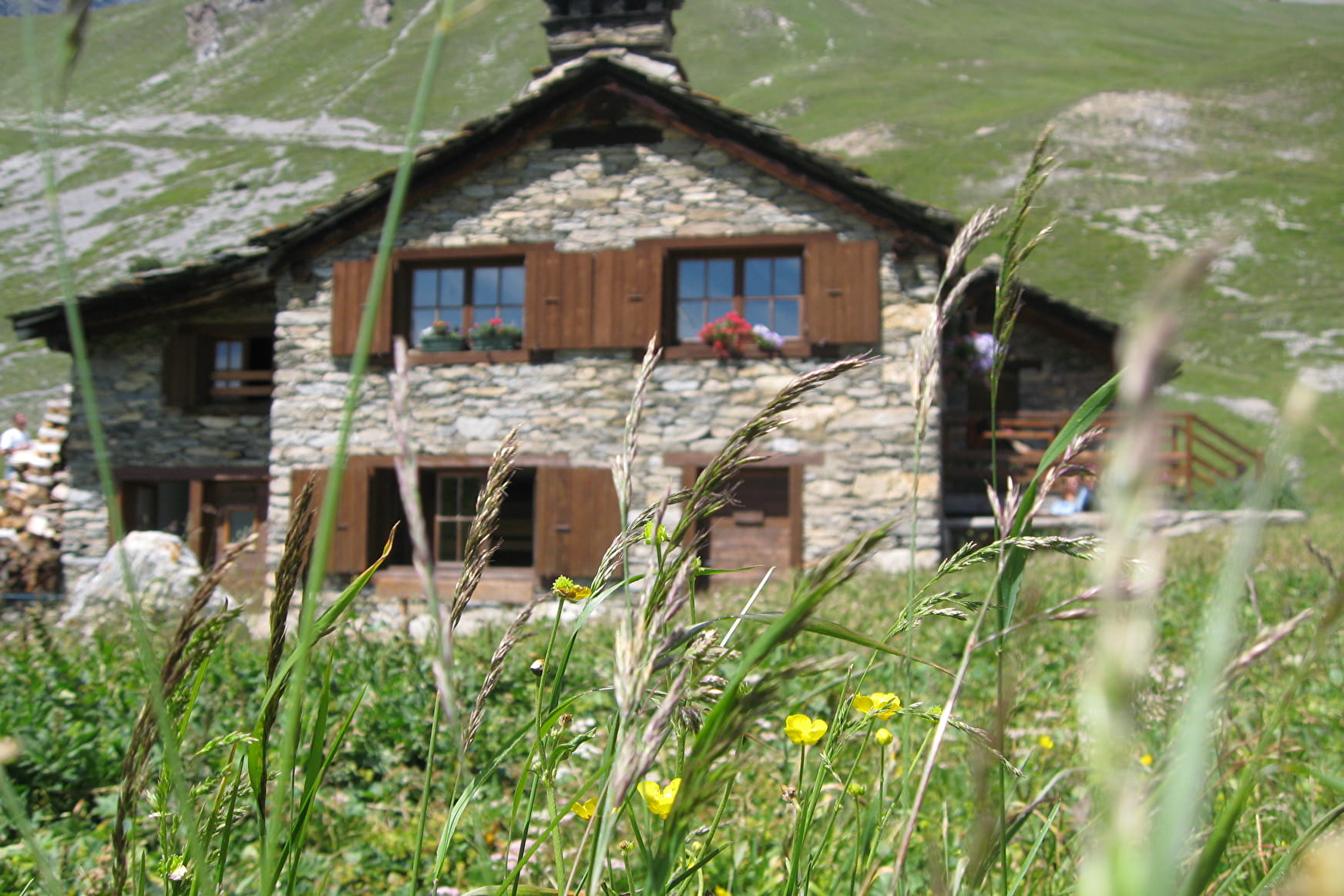
You may be wondering why the lower part of your itinerary appeals to via ferrata enthusiasts. As soon as you step onto the path, the ridges start to unfold before your watchful eyes. This is a dream spot for climbing activities. The highlight of your ascent takes you through rhododendrons, wild blueberry bushes, and steppe moorland. You're in a marmots' paradise and they're keeping a close eye on you. Skipping between burrows incessantly, they incite you to often stop and watch them, so that the ascent feels like no effort at all. When the snow melts, the mountain echoes with the sound of torrents. Keep your eyes peeled and you might spot a few chamois coming down to find food, when the high-altitude cirques are still adorned with snow. As you pass the charming St-Antoine chapel, it seems to celebrate your arrival. A few steps more and you can treat yourself to a delicious food stop at Vallonbrun refuge. Allow yourself to dream of a multi-day adventure. Maybe next time?
- Sport
The Refuge of Vallonbrun
Start out with an approach hike on a sunny slope dotted with rocks and sparse vegetation. Step into Vanoise National Park with this unforgettable ascent to a mountain refuge. The wide, open spaces seem to spread welcoming arms out to you.
About
Signs
Mixed marking (PNV and GR)
Difficult passages
A few stream crossings. Presence of snowfields at the start of the season.
Map references
Map and booklet "Walks and Hikes Haute Maurienne Vanoise" (sold for € 10 at the Tourist Office)
Topoguides references
Orange route n°68
Further informations
Rock, Stone, Ground
To guide you in the field, consult the "step-by-step" directional diagram provided in pdf.
Prices
Free access.
Reception
The duration of hiking trails is calculated using reference paces: 300 m/h ascent, 500 m/h descent and 4 km/h on the flat.
As hazards may occur at any time on the routes, the GPX tracks provided are not contractual. They are given for information only. Riders use them at their own risk, depending on their level of technological proficiency and their understanding of the terrain.
Period of practice
From 01/06 to 15/10.
Subject to favorable snow and weather conditions.
- Parking nearby
Contacts
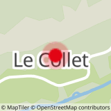
Access
I get there by car: on leaving the village, take the RD902 to Pré Clot, then the small parallel road to Hameau du Collet.