


To fully appreciate this hike, you'll probably want to spend a night in one of our
a night in one of the refuges along the way. Adventure in the land
of high-altitude meadows and wide-open spaces. As you approach the Plan du Lac refuge, you enter the world of marmots, chamois and lammergeiers. In the distance, the road ahead still seems long, and the glaciers seem to approach as you walk. Framed by La Grande Casse and Pointe de la Réchasse, follow in the footsteps of seasoned mountaineers. The sometimes steep climbs contrast with the long, welcoming valley that awaits you. A string of lakes - and the passage of many hikers in summer - announce your proximity to the pass. Another world opens up on the outskirts of Lac Rond. For those accustomed to the area, the retreat of the glaciers is obvious.
- Sport
Col de la Vanoise and its Refuge
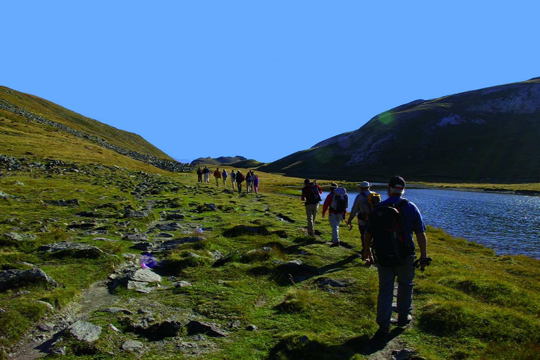
Get up close and personal to the glaciers of the Vanoise, at altitudes of up to 2,500 metres. Embark on a journey along one of the National Park's most iconic routes. For the ultimate high-mountain experience, what better than passing through three refuges?
About
Signs
Parc National de la Vanoise (PNV) markers
Map references
Map and booklet "Walks and Hikes Haute Maurienne Vanoise" (sold for € 10 at the Tourist Office)
Topoguides references
Black route n°100
To guide you in the field, consult the "step-by-step" directional diagram provided in pdf.
Prices
Free access.
Reception
The duration of hiking trails is calculated using reference paces: 300 m/h ascent, 500 m/h descent and 4 km/h on the flat.
As hazards may occur at any time on the routes, the GPX tracks provided are not contractual. They are given for information only. Riders use them at their own risk, depending on their level of technological proficiency and their understanding of the terrain.
Period of practice
From 01/07 to 01/10.
Subject to favorable snow and weather conditions.
- Parking nearby
Contacts
Access
By bus: Line 2 - Parking de Bellecombe stop
By car: park in the Bellecombe parking lot (charge July-August).