- Sport
Villarodin - Le Bourget
A municipal road which crosses the River Arc and connects the villages.

About

Map references
Map and booklet "Walks and Hikes Haute Maurienne Vanoise" (sold for €4 at the Tourist Office)
On leaving Villarodin, take the quiet municipal road towards Le Bourget. This very pleasant road crosses the Glaire Bridge. In Le Bourget, on the southern slope, you'll see some terraced gardens. This village stands at the base of the Orgère Valley, a gateway to the Vanoise National Park.
Prices
Free of charge
Reception
The duration of hiking trails is calculated using reference paces: 300 m/h ascent, 500 m/h descent and 4 km/h on the flat.
As hazards may occur at any time on the routes, the GPX tracks provided are not contractual. They are given for information only. Riders use them at their own risk, depending on their level of technological proficiency and their understanding of the terrain.
Period of practice
From 01/05 to 15/10.
Subject to favorable snow and weather conditions.
- Pets welcome
Contacts
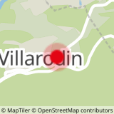
Access
Park in the car park at the entrance to Villarodin.
In summer, it is possible to take bus line S53 (Modane - Bonneval/Arc) and get off at the "Aire de chainage" stop.
- Accessible for wheelchairs with assistance