


To fully enjoy the tranquility and secure a parking spot, we recommend doing
this sunny hike in the spring or autumn.
In the summer, it's best to set off with the first breezes so you can hear the
morning calls of the marmots. Bounding along to nibble on their breakfast
amidst rhododendrons and tall grasses, they'll gladly accompany you, so
long as you stay quiet.
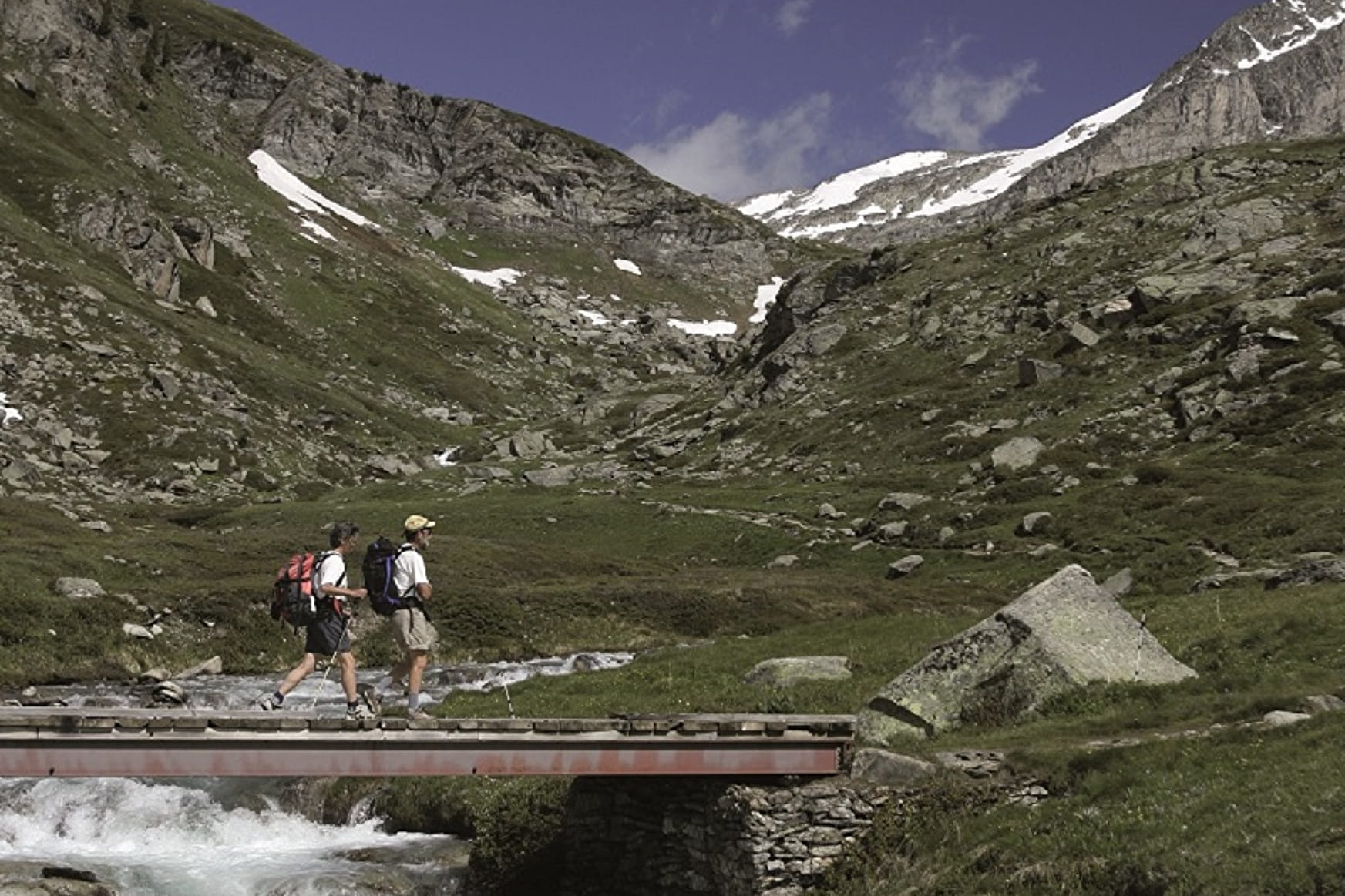
After pausing to watch them, you pick up the pace and as the path gets
slightly steeper, you sometimes feel the pebbles rolling under your feet.
The few mountain bikers you pass smile at you and seem to say: "just a bit
further and you'll get what you deserve: a stunning view of the lakes and
Dent Parraché, queen of the realm".
When you get to the bridge, you promise yourself that, on your next trip,
you'll go even further.
In the meantime, you can choose to either head back the way you came or
cross the Saint-Benoît torrent to return via the Fournache refuge. Isn't there
a waterfall of the same name a little lower down? Here's a hint: see you
under the Avrieux sun...
- Sport
Sétéria Bridge
Embark on an adventure in the Vanoise National Park... Marmots accompany
you on the lush high-altitude meadows as sparkling streams joyfully
bubble their way down the mountain. With your family or on your own,
this hike's a relaxing first step towards Fond d'Aussois.
About

Signs
Mixed marking (PR and PNV)
Map references
Map IGN 3534OT - Les Trois Vallées
Topoguides references
Map and booklet "Haute Maurienne Vanoise. 115 walks and hikes - 35 trail routes. For all levels" (sold for €10 in Tourist Offices) - Itinéraire bleu n°27
Further informations
Ground
To guide you in the field, consult the "step-by-step" directional diagram provided in pdf.
Prices
Free access.
Reception
The duration of hiking trails is calculated using reference paces: 300 m/h ascent, 500 m/h descent and 4 km/h on the flat.
As hazards may occur at any time on the routes, the GPX tracks provided are not contractual. They are given for information only. Riders use them at their own risk, depending on their level of technological proficiency and their understanding of the terrain.
Period of practice
From 01/06 to 15/10.
Subject to favorable snow and weather conditions.
- Parking nearby
Contacts
Access
By car: Park in the Carrière parking lot between the Plan d'Amont and Plan d'Aval lakes.