- Sport
Le col de la Sachette
Sport Le col de la Sachette Peisey-Vallandry

About

1 4


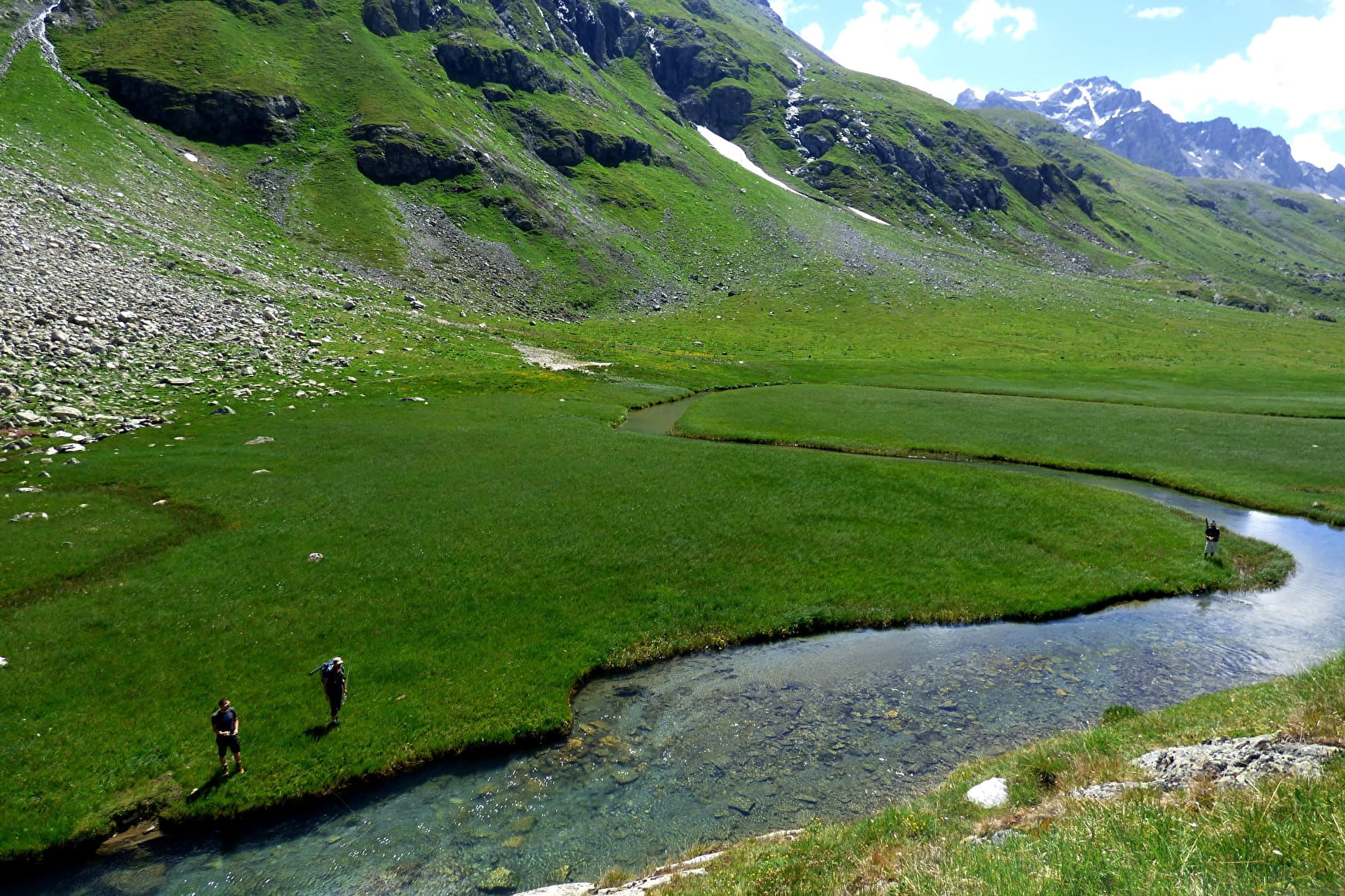
From Rosuel, follow the GR5 to the upper valley. Take the path on the left towards the Plan de la Plagne (you are entering the park). Just before these houses, take the path rising again to the left until you reach the Sachette valley. The pass is to the south in a stony corridor, often windy.
Return by the same path. The nearest refuge is the Col du Palet.
Difficulty: difficult (long) Overnight stay in a refuge recommended! To be avoided in case of fog.
Prices
Free of charge.
Reception
Period of practice
All year round.
Contacts
Access
Parking at the Rosuel refuge


