A charming loop starting from the village center of Albiez-Montrond, this itinerary has very little difference in altitude, allowing you to take a step back from the village center and contemplate the surrounding countryside.
It's also possible to reach the top of the hill (allow a further 20 minutes) for a 360° panoramic view over the village.
- Sport
Tour des Contamines
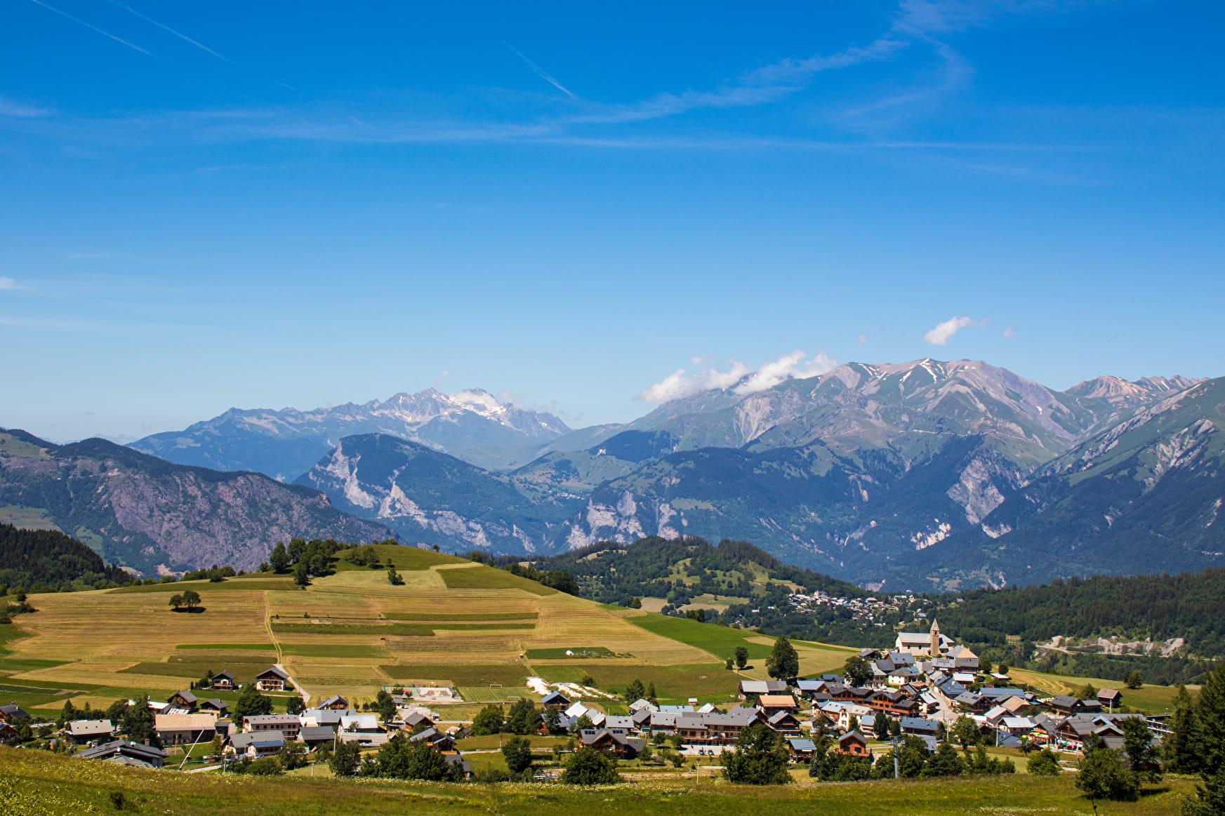
Enjoy a short walk on the balcony near the village and Les Contamines leisure area. Enjoy views of the villages of Albiez-Montrond and Albiez-le-Jeune, the Étendard glacier and the Aiguilles d'Arves.
Sport Tour des Contamines Albiez-Montrond
About

Map references
- Map Vallées de l'Arvan et des Villards (1/25000 with IGN data) available at 7€ in our Tourist Offices during opening hours. - Available on our "Pays des Aiguilles d'Arves" application, downloadable free of charge onto your smartphone.
Further informations
Ground
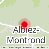
1 9


0/ Start on rue Froide, opposite the Constantin tobacco bar.
1/ Take rue Froide until you reach the Plaine intersection.
2/ Turn right.
3/ Follow the path around the Butte des Contamines.
Prices
Free access.
Reception
Period of practice
From 01/01 to 31/12.
Subject to favorable weather.
Services
- Pets welcome
- Free car park
- Car park
- Public WC
- Picnic area
- Play area
Contacts
Access
- Not accessible in a wheelchair


