A delightful trail linking Saint-Jean-de-Maurienne to Montandré, giving you a bird's eye view of the historic capital of the Maurienne. On this open, easy route, you'll catch a glimpse of the Aiguilles d'Arves and then reach the Montandré chapel, a perfect spot for a relaxing break and a sunny picnic. The area is open to the public and offers a range of facilities for discovering the flora and fauna.
What to see / What to know :
Every year, during the September 8 pilgrimage, pilgrims gather in front of each oratory before attending an open-air mass in the grounds of the Notre Dame de Montandré chapel.
- Sport
Chapelle de Montandré - Hiking trails
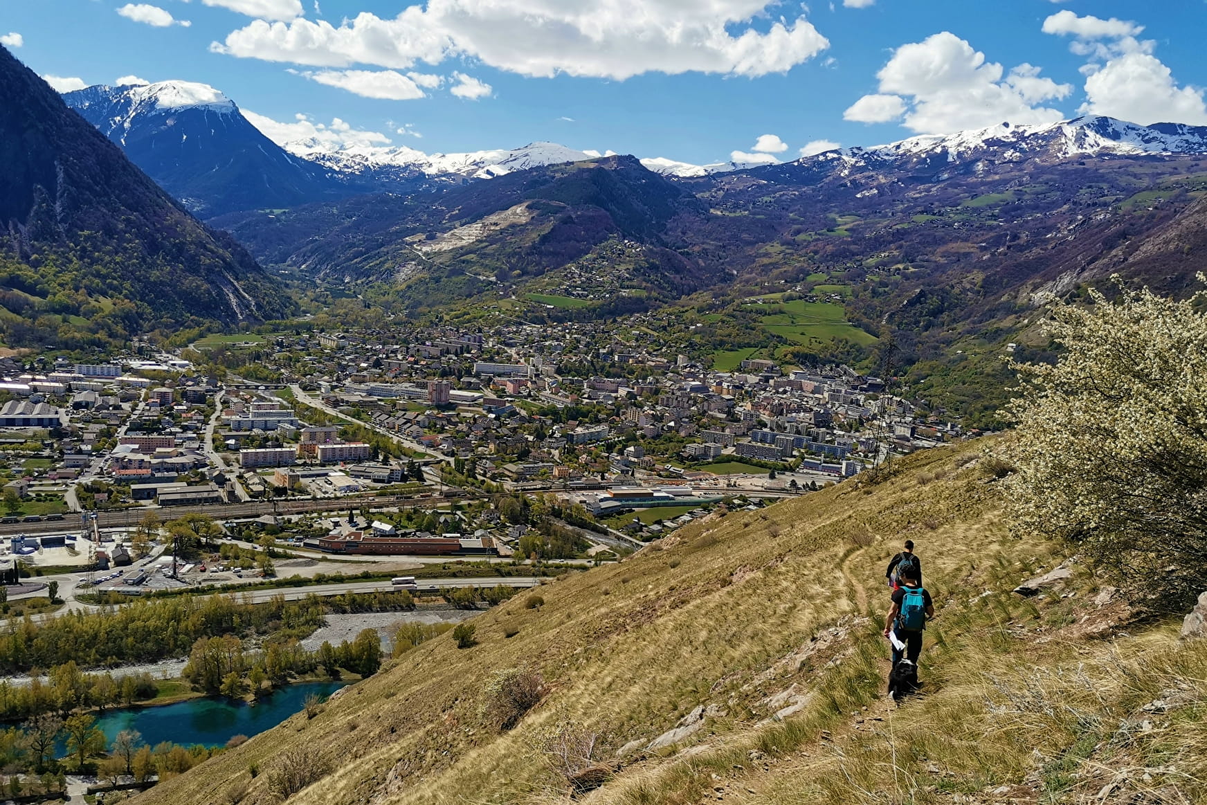
Since the esplanade of the chapel, the view on the city of Saint-Jean-de-Maurienne is magnificent and we can make a survey on the mountains which surround it.
Sport Chapelle de Montandré - Hiking trails Saint-Jean-de-Maurienne
About

Further informations
Ground
1 3


Departure/ Opinel Museum - Opposite the museum, go down Rue du Grand Coin.
2/ Bastille :
Turn right onto rue Louis Sibué. At the end of this street, continue under the railway bridge onto rue René Cassin.
3/ René Cassin :
At the end of the street, leave the road and take the path around the bend. This path passes under the bridge of the departmental road, skirting the Arc and Arvan rivers.
4/ L'Arvan :
After the stairs, turn right. Walk on the bridge over the Arc for a few metres (secure sidewalk), before taking a path to the right. Here you can see the confluence of the Arc and Arvan rivers.
5/ L'Arc :
At the end of the footpath, turn left onto the Route de Longefan (take care to walk on the left side of the road on the other side of the barriers).
6/ Sur les Bains:
Cross the road and continue towards the EDF zone at Longefan.
7/ Longefan :
At the EDF zone, fork right onto the track to reach the village of Montandré and its chapel.
8/ L'Echaillon :
Leave trail L04 and take trail S11 to the right to begin the climb to Montandré (approx. 335 m ascent and 2 km). Be careful, a few metres after the signpost, you'll come to a short, slightly tricky section on the rock (safe path with handrails).
9/ Gros Mollard :
Continue uphill, taking the left-hand path.
10/ Montpasset :
When you reach the meadows, you may be lucky enough to spot some ibex.
To continue along the path towards the village, turn right and then straight ahead along the edge of the meadow.
11/ L'Erable :
End the ascent to the village by continuing straight ahead on path B07.
12/ Montandré - School :
You have reached Montandré. The building in front of the sign used to be the village school. The Montandré chapel is on your left. You can also extend your discovery of the village by continuing on the B07 loop. To return to Saint-Jean-de-Maurienne, turn around.
Reception
Period of practice
Throughout the year : open daily.
Services
- Pets welcome
- Car park
Contacts
Access
- Not accessible in a wheelchair


