From Romme to Lays: 60 minutes
Follow the D119 for 150 meters towards Le Reposoir, passing in front of the pool. At the Romme trail sign, next to a cross, take the small road on the left which goes up towards Les Creux de Sable at 0:15.
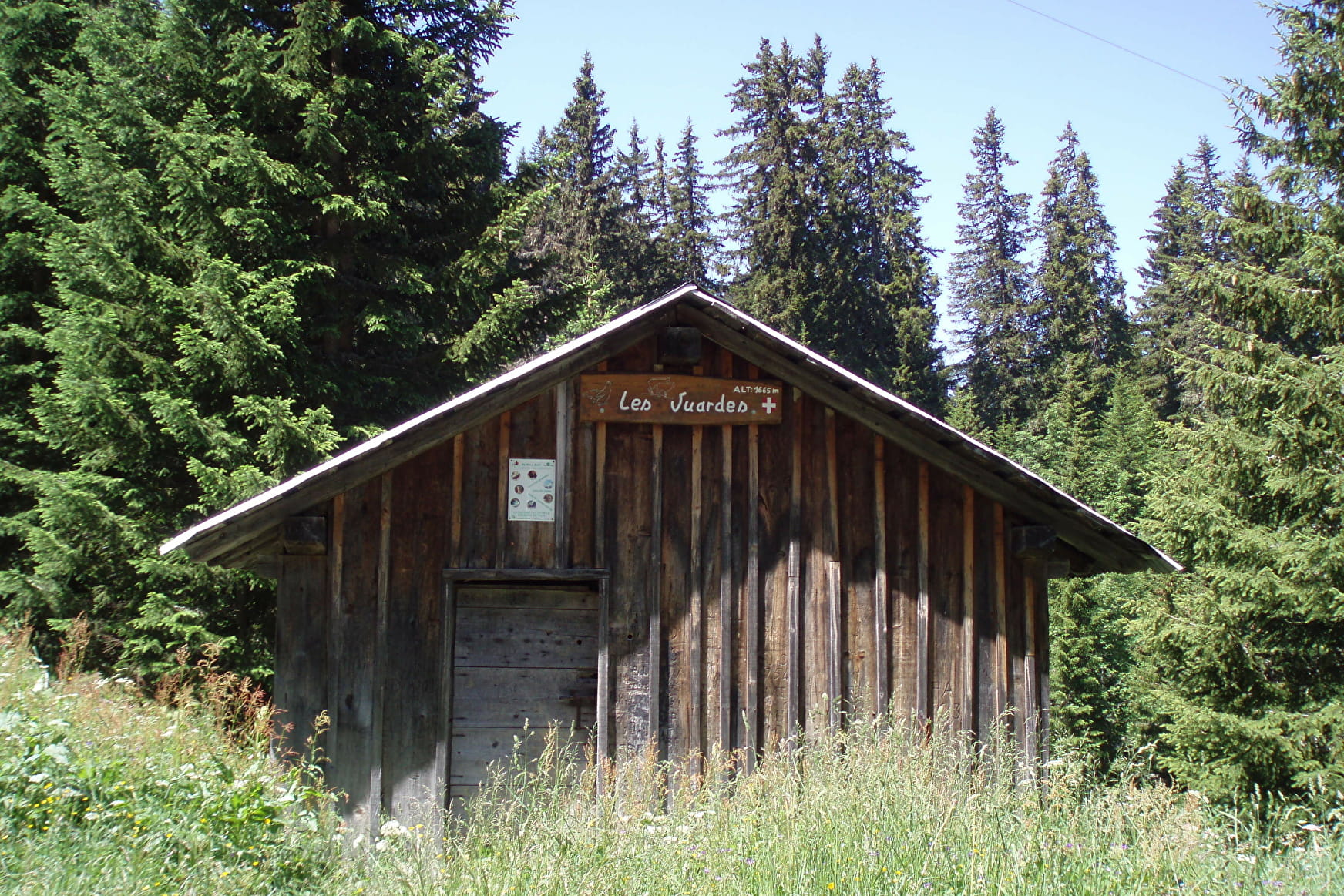
At Creux de Sable, take the 4x4 track on the left towards Chalet des Vuardes via Les Lays. This wide track crosses the ski slopes before climbing regularly in the forest. Follow it and enjoy the view of the hamlet and the valley.
From Lays to Chalet des Vuardes: 15 minutes
After a few switchbacks, you will pass the Lays, 15 minutes before the Chalet des Vuardes, staying on the same track.
From Chalet des Vuardes to Romme: 35 minutes
At Chalet des Vuardes, take the path on your right, under the chalet, in the direction of Romme direct by the Grand Tour ski slope (raid trail). The descent is gentle to the top of the ski lift. When you get to the ski lift, continue straight on the same path. After a wide bend on the left, the path goes straight down to find the track from the start of the loop.
To do more from the Chalet des Vuardes:
- Chalets de Vormy: 1h15 to go
- Col de Gueule à Vent: 1h35 one way
- Chalets de Chérente: 1h50 to go
- Pointe d´Areu (route not marked): 3h25 one way
Step-by-step guide :
Start: Romme car park 1/ From Romme, head towards the ‘Pointe d'Areu’. Always follow the signs for ‘Pointe d'Areu’, passing through ‘Romme’, ‘Le Creux de Sable’, ‘Les Lays’, ‘Chalet des Vuardes’, ‘Porzet’, ‘Sous la Tête de la Sallaz’ and then ‘Sur Chalet de Vormy’ 2/ From ‘Sur Chalet de Vormy’, follow the signs for ‘Col de la Gueule à Vent’. Continue in this direction, passing through ‘Chalets de Vormy’ and ‘Sous Tête des Muets’ 3/ Once you have reached ‘Col de Gueule à Vent’, start the return journey along the same route as the outward journey, following ‘Sur Chalets de Vormy’. At ‘Sous Tête de Muets’, follow the same route as before, heading towards ‘Tête de la Sallaz’. From ‘Sur Chalets de Vormy’, always follow the signs for ‘Romme’, taking the same route as before.
- Sport
Vuardes and Vormy mountain pastures - Hike
Savoie Mont Blanc's choice
Secure route that allows to take the height to overlook the hamlet of Romme.
Sport Vuardes and Vormy mountain pastures - Hike Nancy-sur-Cluses
About

Signs
Trail marked with directional posts (PDIPR)
Map references
TOP 25 IGN 3430 ET
Further informations
Ground
Prices
Free access. Topo rando on sale at the Tourist Office.
Reception
Keep your dog on a leash, he can scare off herds and wild animals.
Period of practice
From 01/04 to 15/11.
Subject to favorable weather.
Services
- Pets welcome
- Restaurant
- Public WC
- Picnic area
Contacts
Access
From Cluses, take the D119, direction Nancy-sur-Cluses. Go through Nancy, and continue on the D119, to Romme station. Cross the hamlet of Romme and park at its exit in a car park with a bus shelter and a pool.