

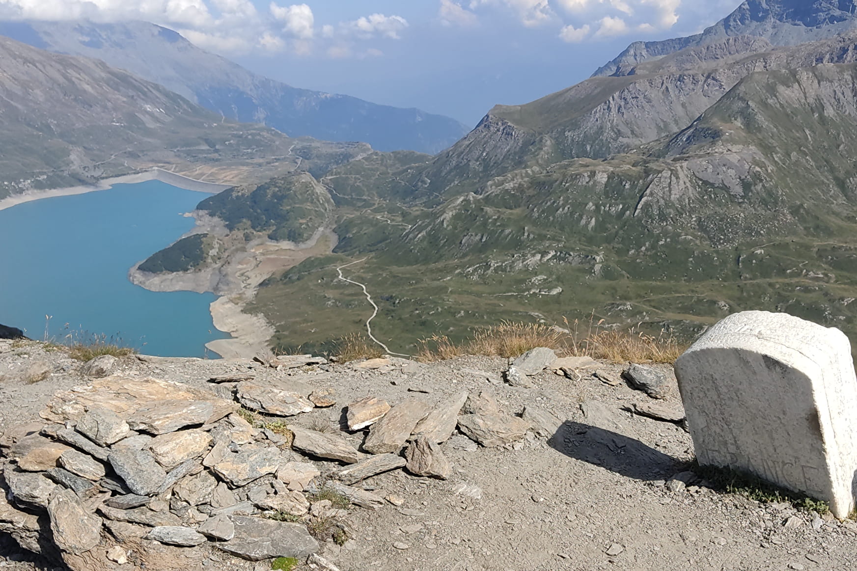
In the first ascent up to La Turra Fort, the sections with handrails will require your attention. But these challenges are short-lived. Climb without hesitation! After a relaxing break at the fortress, enter lunar landscapes. Welcome to the rocky paradise of chamois! Can you hear the echo of stones rolling under their hooves? The remains of buildings that once lined the former French-Italian border are strewn along the trail. From its 2,700 m of altitude, Pas de la Beccia offers you an astonishing view of Mont Cenis lake. After a challenging descent that'll test your hiking boots, make your way to the lush meadows and Great Yellow Gentian flowers in full bloom. Recover your sense of tranquillity among the herds grazing on the gentle slopes. Marmots, well hidden in the tall grass, scurry away as you pass. Make a stop at La Vachère farm for some delicious food that'll wipe away the monotony of the last mile. To recharge your energy, you might even have the chance to savour milk freshly drawn from the latest milking.
- Sport
Le Pas de la Beccia
After a stop at Fort de la Turra, venture out on a loop steeped in history. Treat yourself to a day of astonishing discoveries, in return for some demanding exercise. To make sure your excursion's a success, allow plenty of time and check that the weather forecast is entirely favourable.
About
Signs
Mixed signposting (PR and GR)
Map references
Map and booklet "Haute Maurienne Vanoise. 103 walks and hikes - 38 trail trails. For all levels" (sold for €10 in Tourist Offices)
Topoguides references
Black route n°101
To guide you in the field, consult the "step-by-step" directional diagram provided in pdf.
Prices
Free access.
Reception
The duration of hiking trails is calculated using reference paces: 300 m/h ascent, 500 m/h descent and 4 km/h on the flat.
As hazards may occur at any time on the routes, the GPX tracks provided are not contractual. They are given for information only. Riders use them at their own risk, depending on their level of technological proficiency and their understanding of the terrain.
Pets allowed on leash only.
Period of practice
From 15/05 to 15/10.
Subject to favorable snow and weather conditions.
- Pets welcome
- Parking nearby
Contacts
Access
I'm going by car: park in the parking lot at the Col du Mont-Cenis.