Mont Cenis Pass can be reached by car or by the ski lifts via an easy 3 km ascent from Val Cenis. Find out beforehand about lift opening dates and times.
This high-mountain itinerary explores wide open spaces and keeps you at an elevation of around 2000 metres throughout. You'll start with a warm-up on the Petit Mont Cenis road which then dwindles to a track to take you around the lakeside wilderness. You'll pass below the forts of Pattacreuse and Malamot (look up, the latter stands at an elevation of 2917 metres). After passing Variselle fort, you'll return to "civilisation" via the damn, crossing the road before climbing the "Sentier des 2000" path up to the fort of Ronce. A short descent across Alpine pastures then leads you to a narrow, singletrack balcony of exquisite beauty! But remember to watch your balance as there are a few giddying sections. Once you reach the hamlet of La Buffaz it's a gentle ride down to Mont Cenis Pass. In the Haute Maurienne Vanoise MTB area, this trail is a must-do!
- Sport
Cross-country : Lac du Mont Cenis
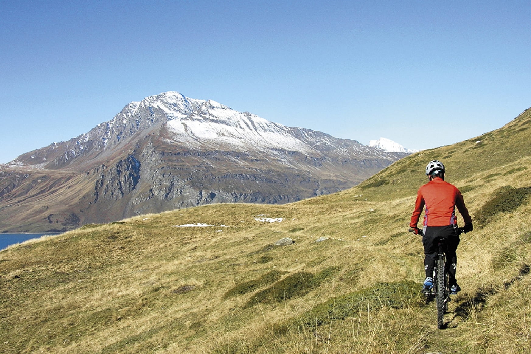
A famous scenic loop to admire the marmots and fortifications around Mont Cenis Lake. With so much to see you might forget to concentrate on keeping your balance. Spectacular is the best word to describe this itinerary.
About

Signs
French Cycling Federation markings (cross-country)
Difficult passages
The course is generally not very technical, only a short section before the Ronce fort is spiky. On the other hand, the technical variant is more challenging with a narrow balcony path with a few calls to the void, a good balance is therefore necessary but this passage is magnificent! The climb from the Mont Cenis dam to the Ronce fort is the most difficult part of the route. Otherwise, the climbs are not very steep or too long.
Topoguides references
Haute Maurienne Vanoise mountain bike map and booklet sold for €4 at Haute Maurienne Vanoise Tourist Offices.
Further informations
Stone, Ground, Grit

Prices
Free access.
Period of practice
From 01/06 to 15/10.
Subject to favorable snow and weather conditions.
- Accessible via ski lift
- Parking nearby
Contacts
Access
The start of this route is at the Col du Mont-Cenis.
I go by car: park in the Col parking lot.
Alternative departure point: Télécabine du Vieux Moulin in Val Cenis Lanslevilard.
I'll get there by bus: Line S53 - Télécabine du Vieux Moulin stop (in summer, bus equipped with bicycle trailer - ask about days and times).
By car: park in the parking lot next to the cable car.
Then take the Télécabine du vieux moulin (open during summer vacations). You'll need to cross a 4km stretch of mostly downhill slope, and park at the Col du Mont-Cenis parking lot.