Snowshoe route n°9: Chemin Pierre Bozon
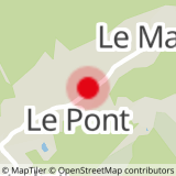
Departure: Chef Lieu St Colomban - Opposite the Remarkable Tree, (The lime tree next to the Town Hall)
Description: From the capital of Saint Colomban, take the "Pierre Bozon" forest path, the start of which is opposite the Remarkable Tree (Tilleul next to the Town Hall).
Continuing straight, this path will take you to the hamlet of Les Roches.
Then join La Perrière by going down the hamlet on the main road.
Once at the leisure area, take the path on the left next to the snack bar, which leads to the village hall.
Possibility to join walk n°5 Chemin des Galapias, at the level of the leisure area.
Return: Loop by the same route.
Note: Very “easy” family discovery walk, from one hamlet to another.
- Sport
Snowshoe route: Path Pierre Bozon
Map of walking and snowshoeing routes available for download on this page and from the Espace Glandon Tourist Office.
About
Prices
Free access.
Reception
Period of practice
From 02/12 to 14/05.
Subject to snow conditions.
Equipments
- Parking nearby
Contacts
Access
