- Sport
Petit Argentier pass
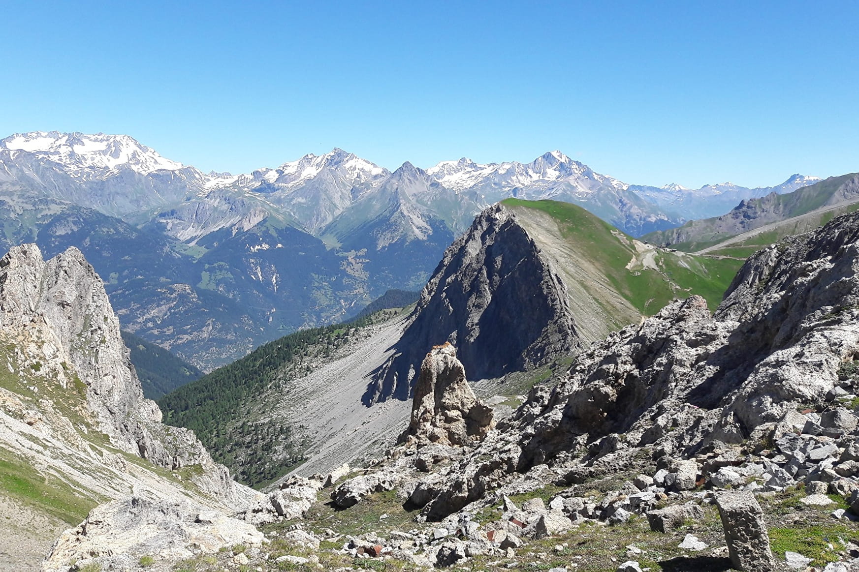
From Valfréjus, follow the path of the game (go through the Lavoir)
Walk sideways across the N slopes to the Roc 2323m.
Climb the NE combe back up to the Petit Argentier pass (35°/100m).
About

Map references
IGN - 3535OT - Névache - Mont Thabor - Galibier and Lautaret passes
Further informations
Stone, Ground
From Valfréjus, follow the path of the game (through the Lavoir) Cross the N slopes to the Roc 232323m. Then climb the NE combe back up to the Petit Argentier pass (35°/100m)
Prices
Free access.
Reception
The duration of hiking trails is calculated using reference paces: 300 m/h ascent, 500 m/h descent and 4 km/h on the flat.
As hazards may occur at any time on the routes, the GPX tracks provided are not contractual. They are given for information only. Riders use them at their own risk, depending on their level of technological proficiency and their understanding of the terrain.
Period of practice
From 15/05 to 15/10.
- Pets welcome
Contacts
Access
In the summer season, it is possible to take bus line 1 Modane - Valfréjus and get off at the terminus.
By car, park in the Tourist Office car park.