
The Avérole torrent acts as your guide throughout the journey. Fed by streams and glacial lakes that overlook the Lombarde valley, it's a refreshing place for both young and old to rest along the way. The trail, which is often playful and always well-maintained, encourages you to maintain your speed. Marmots whistle from distant hiding places, and who knows... there may be chamois up there in the shade of the cliffs, watching you as you go by. These grand, cinema-like landscapes fill you with energy. At this altitude on the south-facing slope, you feel the soft, warm caress of the sun on your face. What a strange feeling when you arrive at your destination! The torrent gently flowing through the village of Avérole is now a distant memory. Here at the shepherds' hut, it goes cascading down into a giant, boiling cauldron. The few hours you've spent hiking along the right bank suddenly feel like whole days of adventure.
- Sport
Pas de la Mule from Avérole Refuge
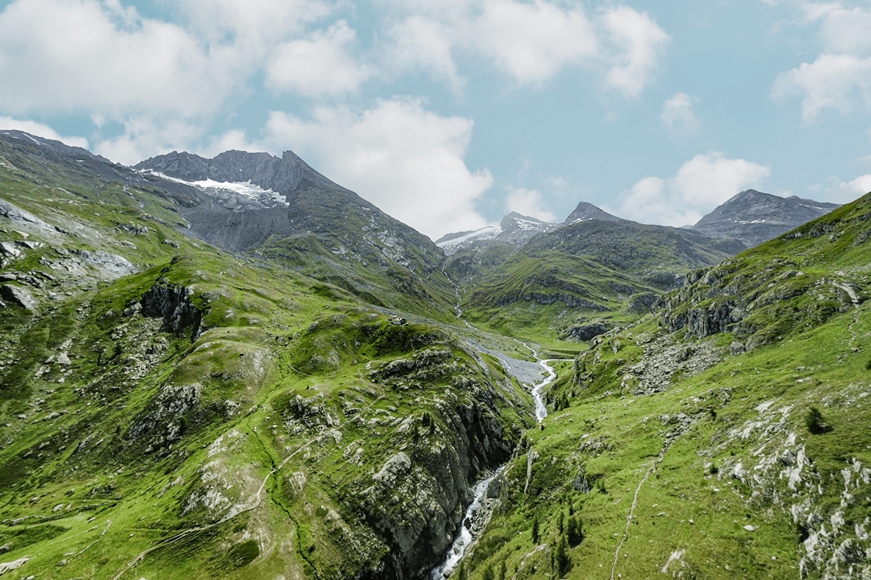
As you walk through this high-altitude valley, near the Italian ridges, look up - up and up! All around you, the secret world of the "3,000s" unfolds in all directions. At the foot of all these majestic peaks, strike out from your own base camp at an easy pace.
About
Signs
Departmental signposting (PR)
Difficult passages
Walkways installed mid-June and dismantled in October
Map references
"Map IGN 3633ET - Tignes Val-d'Isère IGN 3634OT - Val Cenis" map
Topoguides references
Map and booklet "Haute Maurienne Vanoise. 115 walks and hikes - 35 trail routes. For all levels" (sold for €10 in Tourist Offices) - Orange itinerary n°76
Further informations
Rock, Stone, Ground

To guide you in the field, consult the "step-by-step" directional diagram provided in pdf.
Prices
Free access.
Reception
The duration of hiking trails is calculated using reference paces: 300 m/h ascent, 500 m/h descent and 4 km/h on the flat.
As hazards may occur at any time on the routes, the GPX tracks provided are not contractual. They are given for information only. Riders use them at their own risk, depending on their level of technological proficiency and their understanding of the terrain.
Period of practice
From 01/07 to 15/10.
Subject to favorable snow and weather conditions.
- Pets welcome
- Parking nearby
Contacts
Access
To get there by bus: Line 3 - Refuge d'Avérole stop.
By car: park in the Vincendières parking lot, then walk or take the shuttle bus from the parking lot to the starting point.
