- Sport
Tour des Aiguilles d'Arves - Chalet d'la Croë / Chalet du Perron
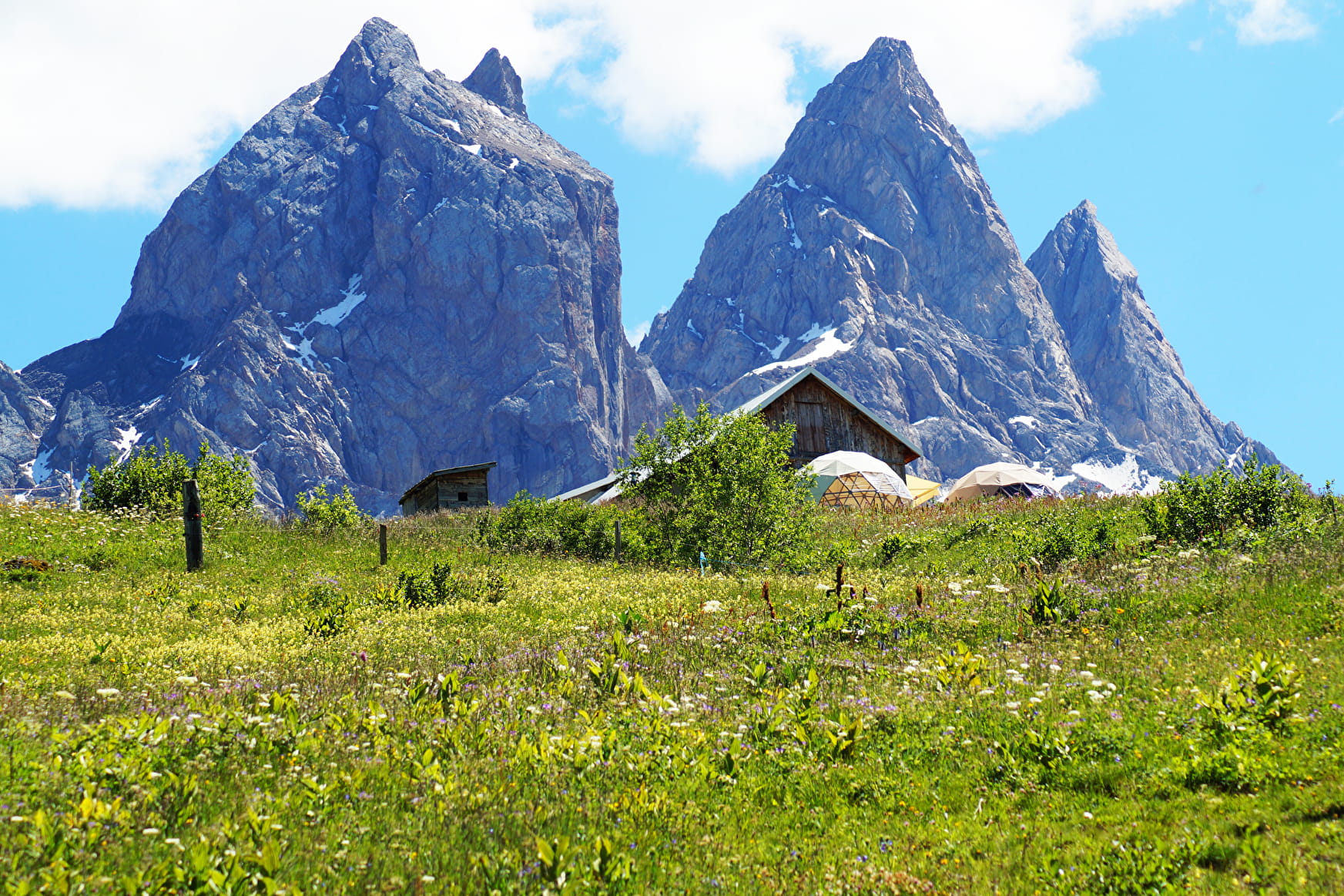
Located on the Tour des Aiguilles d'Arves, this itinerary through the alpine pastures of the Plateau de Montrond takes you from the warm Chalet d'la Croë to the welcoming Chalet du Perron, passing under the Tête de Chat and through the emblematic Basse du Gerbier.
About

Signs
The trail is marked with yellow Tour du Pays des Aiguilles d'Arves signs.
Further informations
Stone, Rock, Ground


1/ Take the path leading south from Chalet d'la Croë to join the track at Bassin.
2/ At La Motte, take the left-hand track, leaving a chalet on your right, cross the stream and follow the ridge to Plan Pradin.
3/ At Plan Pradin, turn slightly right towards Tête de Chat.
4/ At the signpost below Tête de Chat, turn right and follow the ridge to Basse du Gerbier.
5/ Turn left and follow the ridge after 2 zigzags to the La Crête point, continuing downhill to the Col.
6/ From the Col, descend through the mountain pastures to the Chalet du Perron.
We advise you to book accommodation well in advance, given its small capacity.
Recommended equipment :
- Mountain boots suitable for walking on varied terrain (rigid soles)
- Rain gear
- Warm clothing
- Pair of telescopic poles
- Cash (CB terminals not always available in refuges)
Prices
Free access.
Reception
Dogs must be kept on a leash due to the presence of herds.
Period of practice
From 20/06 to 22/09.
Subject to favorable weather.
- Pets welcome
- Parking nearby
Contacts
Access
- Not accessible in a wheelchair


