
The Tour des Aiguilles d'Arves, a hiking trail between Savoie and Hautes-Alpes, takes you on a wilderness adventure, immersing you in a succession of high-altitude passes, panoramic ridges and flower-filled mountain pastures grazed by numerous herds of cattle, goats and sheep.
This interdepartmental itinerary, dedicated to the very best mountain hikers, combines history and trade, wars and peddlers, between the former State of Savoy and the Kingdom of France. On these ancient paths steeped in history, these slopes and ridges, cross the border! To activate geolocation, click on the map icon.
- Sport
Tour des Aiguilles d'Arves : Refuge des Aiguilles d’Arves - Albanne
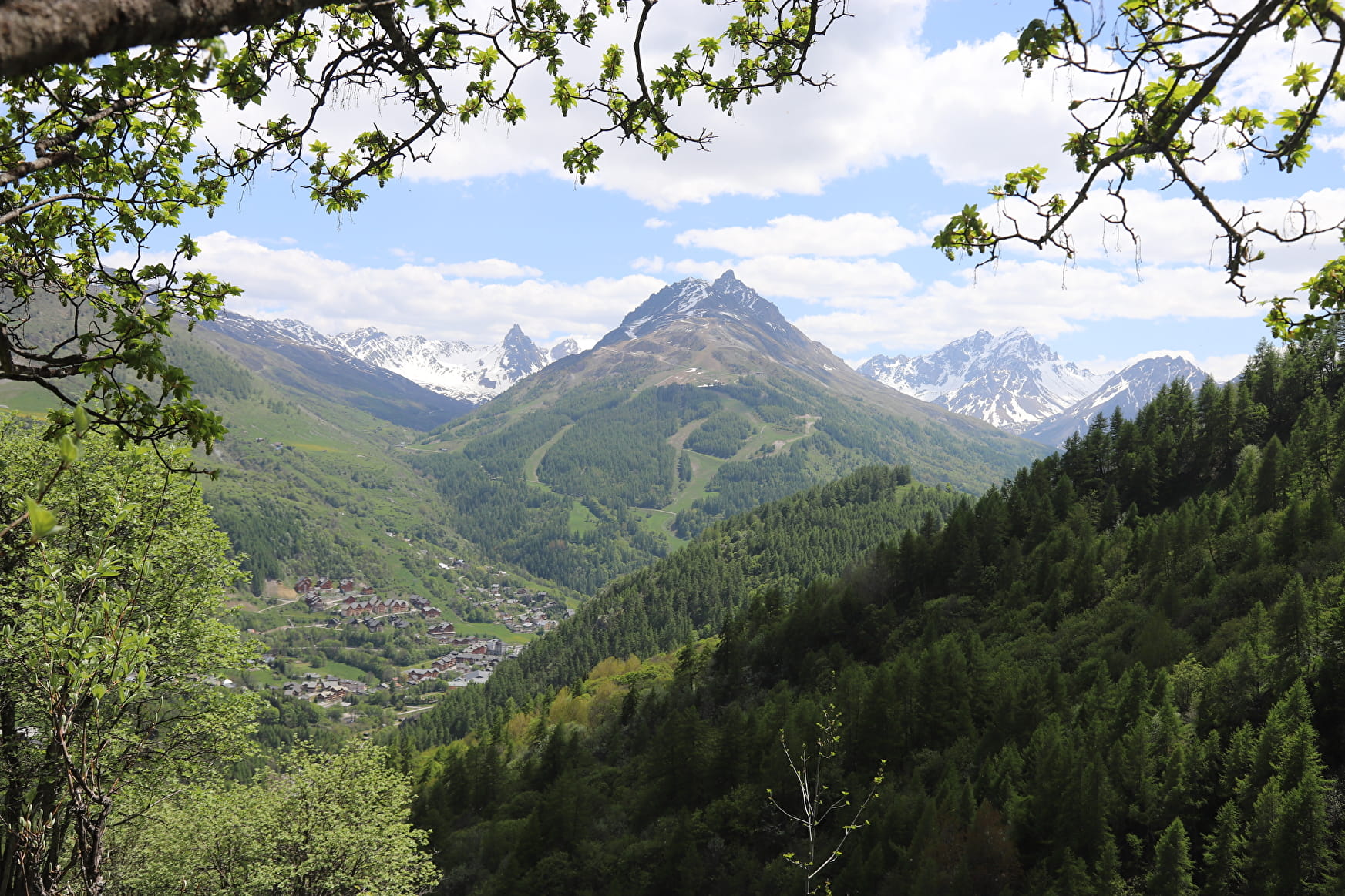
The 6th stage of the Aiguilles d'Arves tour. You'll set off from the Aiguilles d'Arves refuge to reach the hamlet of Albanne, passing through the village of Valloire. This varied, mainly downhill hike is difficult because of its length.
Sport Tour des Aiguilles d'Arves : Refuge des Aiguilles d’Arves - Albanne Valloire
About
Signs
- Yellow paint - Iron stakes for high alpine pastures - Small rappel markers
Difficult passages
Le Mauvais Pas Crossing a stream can be tricky in June, when the snow melts.
Map references
IGN map 3435ET VALLOIRE - Aiguilles d'Arves / Col du Galibier is on sale in Valloire shops.
Further informations
Rock, Ground, Grit
Departure - Refuge des Aiguilles d'Arves, go down to Commandraut on the same path as the day before. 1- At Commandraut, turn left towards the hamlet of Les Verneys. 2 - Cross the hamlet towards the main road. 3- Cross the road and the Valloirette. 4 - Walk along the right bank of the torrent as far as the Valloirette footbridge. 5 - Then climb up to the hamlet of Poingt Ravier. 6- Continue up the balcony path as far as Pain du Sucre, crossing the Villard stream (footbridge installed around June 10 and removed around September 15). 7- At La Turraz, head for the gros Mélèze, take the balcony path on your left at the 1st intersection, then leave the downhill path on your right (after the wetland footbridge) and continue flat out. 8- At the next intersection, take the straight downhill path on your right, crossing the torrent des moulins at the foot of a footbridge. 9 - From here, follow the downhill path to Albanne. After crossing the meadows, turn left at the crossroads, arriving at Albanne.
- Mountain boots suitable for walking on varied terrain (rigid soles)
- Rain gear
- Warm clothing
- (Pair of telescopic poles)
- Cash (CB terminals not always available in refuges)
Prices
Free access.
Reception
To keep the mountains a pleasure, choose an activity suited to your level of experience and physical ability. Check the weather and seek advice from qualified professionals, and tell someone about your itinerary. Set off with the right equipment: good shoes and walking poles. In your rucksack, carry a water bottle and snacks to keep your energy levels up, a survival blanket or warm clothing. Protect yourself from the sun with sunscreen and sunglasses. Don't forget binoculars to add a touch of observation to your adventure.
Due to the presence of guard dogs, we strongly advise you not to bring your dog.
Period of practice
From 15/06 to 15/09.
Subject to favorable snow and weather conditions.