- Sport
Col de la Tourne
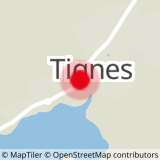


About

Signs
Hellow hiking signs
Topoguides references
Sheet n°6, The Summer Trails (25 walks and hikes in Tignes). On sale in the Maisons de Tignes (€12)
Further informations
Stone, Ground
Prices
Free access.
Reception
Dogs, even on a leash, are not allowed in the Tignes - Champagny Nature Reserve
Period of practice
From 01/06 to 31/10.
Subject to snow conditions.
Equipments
- Parking nearby
- Public WC