- Sport
Bergerie de la Davie


About

Signs
Yellow hiking signs
Topoguides references
Sheet n°21, The Summer Trails (25 walks and hikes in Tignes). On sale in the Maisons de Tignes (€12).
Further informations
Ground
Prices
Free access.
Reception
Period of practice
From 01/06 to 31/10.
Subject to snow conditions.
Services
- Pets welcome
- Parking nearby
Contacts
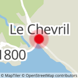
Access
From Tignes le Lac, take the car and follow the D87 to the dam. At the crossroads with the D902, turn right towards Val d'Isère. Park your vehicle in the car park 250 m to the right along the road.