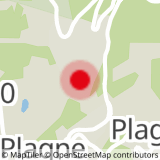
Start from the entrance to the "Charles Albert" mine in Plagne 1800. Follow the road down 200 m, to the bottom of the village. Cross the main road and you will find the path 50 m below. Go to the right in the car park. Take the path and at the 1st junction, stay right towards Cavard. In the clearing at Cavard, follow the path going towards the bobsleigh track to reach hairpin bend no. 5 "Pont de l’Arc". At the bridge, cross the road and go into the bobsleigh track. At the bottom of the track, go to the centre of the village of La Roche. You go back by the same path.
- Sport
The Mountain Mine Trail

Follow the Mountain Mine Trail with information boards along the way
Sport The Mountain Mine Trail La Plagne
About

Further informations
Ground, Hard coating (tar, cement, flooring)
Start at the old entrance to the mine (next to Residence Edelweiss Lagrange
1/ walk down the road to the point where it comes out at the main road
2/ cross the road to Les Mines car park
3/ take the path down on the left
4/ follow the path to the clearing at Cavard
5/ keep on walking down until you meet the main road at the Pont de l'Arc bend
6/ cross the road and walk to the top of the bobsleigh track.
7/ walk onto the actual track
8/ walk down on the track (19 bends)
9/ come out at the bottom of the track
10/ continue to the main car park in the village centre.
Prices
Free of charge.
Period of practice
From 29/06 to 31/08/2024, daily.