To activate geolocation, click on the map icon.
Level of physical difficulty: medium.
Duration: 3h to 5h.
- Sport
8 - Tour de la Roche Olvéra par le Colomban Noir - VTTAE itinerary

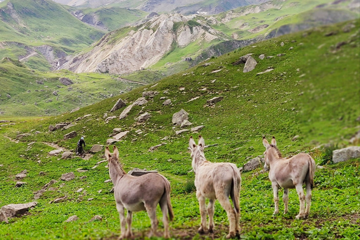
Conquer the mythical Col du Galibier before descending into the pretty valley of La Lauzette! The typical Enduro descent will offer you a very natural playground.
Sport 8 - Tour de la Roche Olvéra par le Colomban Noir - VTTAE itinerary Valloire
About

Signs
The trail is marked with signs.
Difficult passages
Technical part of the sheepfold at La Lauzette
Map references
The VTTAE route map can be consulted at the tourist office. IGN map 3435ET VALLOIRE - Aiguilles d'Arves / Col du Galibier is on sale in Valloire shops.
Topoguides references
Valloire hiking and mountain biking map.
Further informations
Stone, Ground, Hard coating (tar, cement, flooring), Grit
1 2


Departure - From the tourist office, walk up Rue des Grandes Alpes towards the hamlet of Les Verneys 1 - Once you've crossed the bridge, walk along the parking lot to take the footbridge on the left of the main road to follow the "Vitta Vittel" fitness trail 2 - Once you've passed the equestrian center, continue straight ahead to pass the Les Verneys chairlift 3 - Continue straight ahead on the footpath and then the D902 road along the river towards the Col du Galibier. 4 - You'll pass Les Granges du Galibier, where the local dairy sells cheese. 5 - Once you've reached Colomban noir, you have two options: a round trip (via the D902) to the top of the Col du Galibier to enjoy the 360° view, or take the return path directly. 6 - On the return path, you'll pass the sheepfold. There's a technical descent before you reach the Lauzette plateau. 7 - Cross the Lauzette torrent and continue on the path towards Valloire. 8 - Cross the water a second time to rejoin the D902, just before the hamlet of Bonnenuit. 8 - Return to Valloire along the same path as before.
Prices
Free access.
Reception
To keep the mountains a pleasure, choose an activity suited to your level of experience and physical ability. Check the weather forecast and seek advice from qualified professionals, and inform someone of your itinerary. Make sure you're properly equipped: helmets are compulsory, and we strongly advise you to wear kneepads, elbow pads, back protection and gloves. In your rucksack, take a water bottle and snacks to keep your energy levels up, and a survival blanket or warm clothing. Protect yourself from the sun with sunscreen and sunglasses. Don't forget binoculars to add a touch of observation to your adventure.
For your dog's safety, we do not recommend mountain biking.
Period of practice
From 05/06 to 23/10.
Subject to favorable weather.
Services
- Restaurant
- Picnic area
- Car park
- Free car park