

In summer, take advantage of the comfort of the lifts, as it's easier to get to the start via the Roches Blanches chairlift.
Set off to discover a high-altitude loop that will require physical strength if you start directly from the village of Val Cenis Termignon. You'll be surprised by the low grassy ridges contrasting with the dense ubac forest up to the Replat des Canons.
Once well underway, looking south-east, you catch a fleeting glimpse of Lac Martin, marking your entry into wilder lands. The freedom of the great outdoors awaits you. The whistling of marmots escorts you to the Col de Sollières. Perhaps you'll meet up with some seasoned trailers who've climbed from Le Cernay via Les Archettes...
The Mont froid and its steeper slopes were just waiting to seduce you from its former military fort. Share a panoramic view before threading your way under the Signal du Petit Mont Cenis for a playful descent. You'll be intoxicated by the high altitude and fresh air of the Val Cenis ski area!
- Sport
Col de Sollières
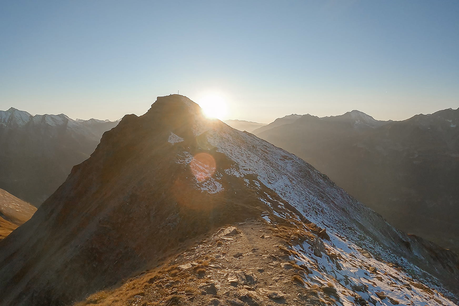
Climb to an altitude of 2640 m for a breathtaking escape. Set off to meet little-known summits and take advantage of open spaces to enjoy the unforgettable views that give the Haute Maurienne Vanoise passes their magic.
About
Signs
Departmental signposting (PR)
Map references
Map IGN 3634OT - Val Cenis
Topoguides references
Map and booklet "Haute Maurienne Vanoise. 115 walks and hikes - 35 trail routes. For all levels" (sold for €10 in Tourist Offices) - Orange itinerary n°68
Further informations
Stone, Ground, Grit
To guide you in the field, consult the "step-by-step" directional diagram provided in pdf.
Prices
Free entry but transport fee applies.
Reception
The duration of hiking trails is calculated using reference paces: 300 m/h ascent, 500 m/h descent and 4 km/h on the flat.
As hazards may occur at any time on the routes, the GPX tracks provided are not contractual. They are given for information only. Riders use them at their own risk, depending on their level of technological proficiency and their understanding of the terrain.
Pets allowed on leash only.
Period of practice
From 01/07 to 01/10.
Subject to favorable snow and weather conditions.
- Pets welcome
- Accessible via ski lift
- Parking nearby
Contacts
Access
The hike starts at Replat des canons - at the top of the Girarde and Roches Blanches chairlifts.
By bus: Line S52 or S53 - Maison de la Vanoise/Mairie stop, then walk to the foot of the slope.
By car: park in the parking lot near the start of the Val Cenis Termignon lifts.