
You gradually ascend to a high-altitude meadow shared with herds and playful marmots. The countless peaks seem to touch the sky with their jutting edges. On your right, hidden behind a low grassy ridge, the Thabor refuge may be your next objective. But now it's time to turn east. Did you know
that you're arriving at the foot of the Italian border? At an altitude of 2287 m, the Memory Trail connects you with the area's military history.
A fascinated glance at the Col de la Roue and you're off to tackle the main difficulty of this hike. Between Petit and Grand Argentier, 25 switchbacks up and 19 down... what better way to blend in with the chamois? Enjoy a refreshing break at the Pas du Roc.
You've done well to overcome this pass, which served as a natural barrier to soldiers. I promise you, if you keep your eyes peeled all the way to the hamlet of Jeu, you'll see the remains of the Maginot Line military barracks dating from the 2nd World War. On the trail back to the Lavoir, you may be overtaken by enduro mountain bikers. No doubt about it, you've explored
a site reserved for mountain enthusiasts.
- Sport
Vallon de la Roue
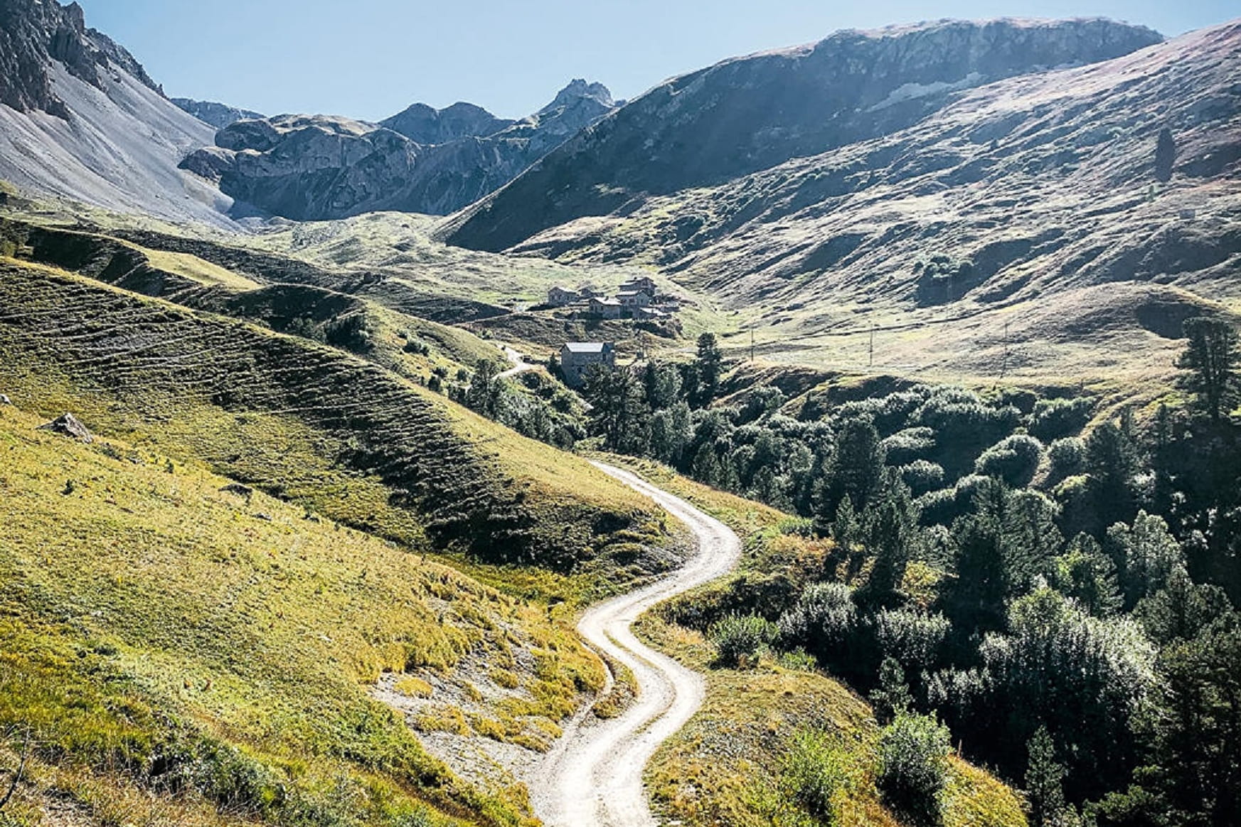
Take a round trip around a characterful valley. Stroll along the luminous foothills of the Valfréjus ski resort to discover a little-known facet of Haute Maurienne.
About
Signs
Mixed signposting (PR and GR)
Map references
Map IGN 3535OT - Névache Mont Thabor
Topoguides references
Map and booklet "Haute Maurienne Vanoise. 115 walks and hikes - 35 trail routes. For all levels" (sold for €10 in Tourist Offices) - Black route n°97
Further informations
Rock, Stone, Ground
To guide you in the field, consult the "step-by-step" directional diagram provided in pdf.
Prices
Free access.
Reception
The duration of hiking trails is calculated using reference paces: 300 m/h ascent, 500 m/h descent and 4 km/h on the flat.
As hazards may occur at any time on the routes, the GPX tracks provided are not contractual. They are given for information only. Riders use them at their own risk, depending on their level of technological proficiency and their understanding of the terrain.
Pets allowed on leash only.
Period of practice
From 01/07 to 01/10.
Subject to favorable snow and weather conditions.
- Pets welcome
- Parking nearby
Contacts
Access
I'm going by car: park in the Lavoir parking lot on the driveway.