


A quick warm-up along Chemin du Petit Bonheur brings you to the start of your adventure from the village of Bessans. Looking up, you can already guess that the journey will occasionally involve a bit of effort. But the ascent remains gradual and you're inspired by the presence of the majestic Charbonnel. From its height of 3,752 metres, the peak seems to watch your progress along the path leading to Vallon d'en Haut. This cosy nest snuggles into the mountainside between the peaks of Bonneval and Bessans. A few stops later, with views that take your breath away, it's safe to say you've earned the status of an aspiring mountain enthusiast. Prolong the pleasure with an unforgettable tasting experience at the Panino Inn... Come on! Push ahead just a bit further: a few steps more than you originally planned, and you'll get to meet locals who love their land and its produce. Sébastien and his family manufacture their own specialties of yogurt, country pies, and traditional Beaufort cheese. Pure taste sensations!
- Sport
Alpage du Vallon
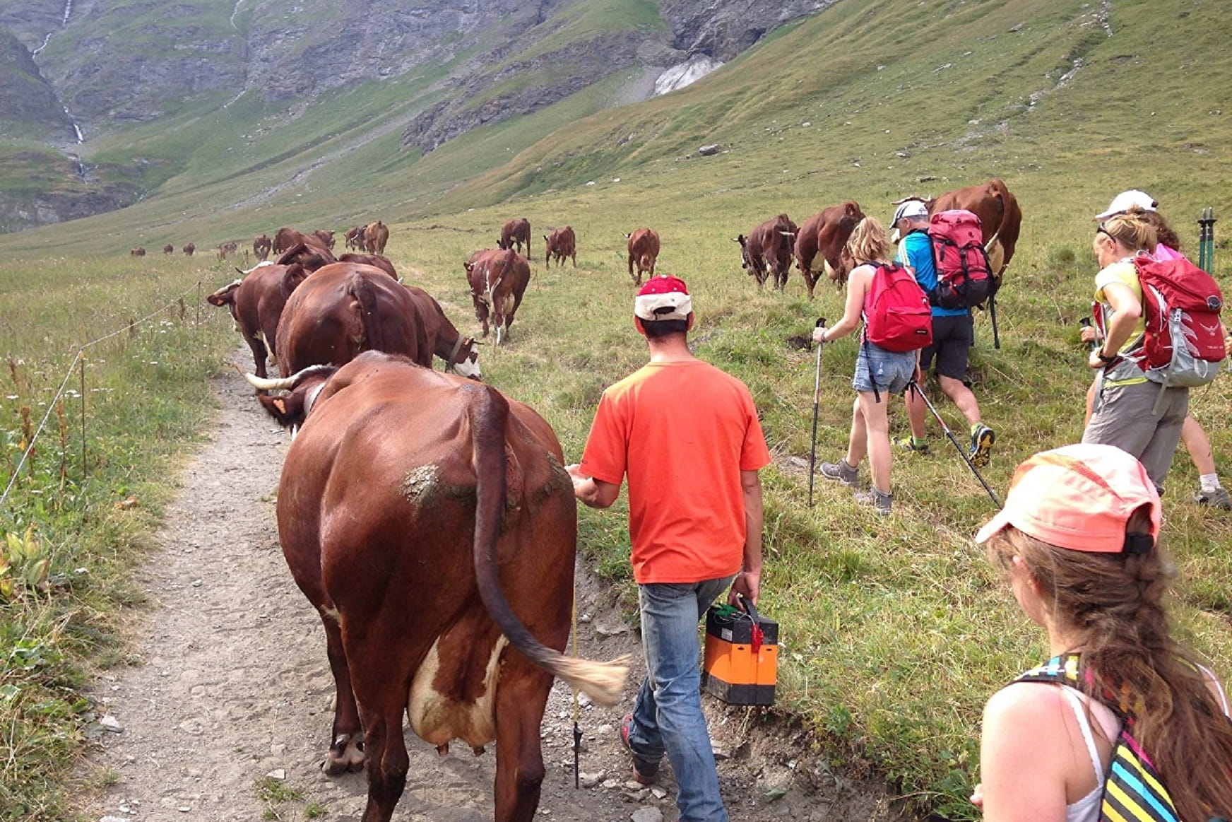
A bubble of fresh air and tranquillity that takes you off the beaten path and away from sites that get busy in the height of summer. Enter the welcoming atmosphere of a secret mountain pasture. A little treasure, hidden at the bottom of the Vallon d'en Haut.
About
Signs
Mixed marking (PNV and GR)
Map references
Map IGN 3633ET - Tignes Val-d'Isère
Topoguides references
Map and booklet "Haute Maurienne Vanoise. 115 walks and hikes - 35 trail routes. For all levels" (sold for €10 in Tourist Offices) - Orange itinerary n°79
Further informations
Rock, Stone, Ground
Prices
Free access.
Reception
The duration of hiking trails is calculated using reference paces: 300 m/h ascent, 500 m/h descent and 4 km/h on the flat.
As hazards may occur at any time on the routes, the GPX tracks provided are not contractual. They are given for information only. Riders use them at their own risk, depending on their level of technological proficiency and their understanding of the terrain.
Period of practice
From 01/06 to 30/09.
Subject to favorable snow and weather conditions.
- Parking nearby
Contacts
Access
By bus: Line S53 - Mairie / La Poste stop.
By car: park in the town hall parking lot or after the bridge towards the Bessans ski lifts.