DEPARTURE: parking SOUS LA BEQUE - hiking information sign.
ROUTE: From the car park, take the road briefly in the direction of Saint Nicolas La Chapelle to the sign "SOUS LA BEQUE" and take the path in the undergrowth to the right. Go up to LA BÈQUE and its superb point of view on the Val d'Arly (caution on the belvedere). Continue towards TRÉ LE SEZ then the BOIS DES AVENIÈRES. Take the track on the right and join LES AVENIÈRES : ideal for a break in front of Mont-Blanc. Go back down the alpine trail via SOUS ZORONS, LES MONTS and reach the car park.
POINT OF INTEREST :
- The orientation table Avenières and its unique panorama facing the Mont Blanc, Beaufortain and Aravis.
- Sport
Avenières loop
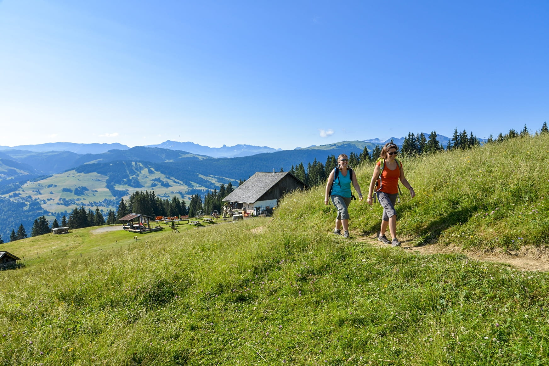
The alp of the Avenières certainly offers one of the most beautiful mountain pastures of the Aravis, facing Mont Blanc.
Sport Avenières loop Saint-Nicolas-la-Chapelle
About

Signs
Marked with yellow signs.
Map references
Walking and hiking map of the Val d'Arly for sale at 9 € or Topo Walks and Short hikes on sale at € 4 in the tourist offices.
Prices
Walking and hiking map of the Val d'Arly for sale at 9 € or Topo Walks and Short hikes on sale at € 4 in the tourist offices.
Methods of payment accepted : Check, Bank/credit card, Cash
Reception
Dogs must be on a leash.
Period of practice
From 01/06 to 30/09.
Services
- Pets welcome
Contacts
Access
Park in the bend before the climb to Les Avenières or continue by car on the passable road that leads to the Alpage des Avenières to park below. Be careful, the path is not paved, only go up if the car is high enough.