- Sport
Clairière des Condus (au départ du Chevril)


About

Signs
Yellow hiking signs
Topoguides references
Sheet n°22, Summer Trails (25 walks and hikes in Tignes). On sale in the Maisons de Tignes (€12).
Further informations
Ground
Prices
Free access.
Reception
Period of practice
From 01/06 to 31/10.
Subject to snow conditions.
Services
- Pets welcome
- Parking nearby
Contacts
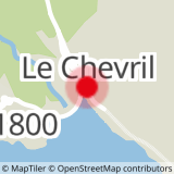
Access
From Tignes by car, turn right after the dam and park in the car park immediately to your right (almost facing the road that goes up to the hamlet of Chevril).