- Sport
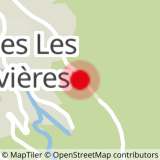
Clairière des Condus (au départ du Villaret des Brévières)


About

Signs
Yellow hiking signs
Further informations
Ground
Prices
Free access.
Reception
Period of practice
From 01/06 to 31/10.
Subject to snow conditions.
Services
- Pets welcome
- Parking nearby
Contacts
Access
From Tignes le Lac, take the car and follow the D87 road to the dam. At the crossroads with the D902, turn left towards Bourg-Saint-Maurice. Drive one kilometer and park immediately after the Brévières tunnel, on the left, on the large median strip.