The Ambin stream will be your faithful companion all day long. Calmly follow its right bank to the Refuge d'Ambin. The sensation of entering an unexplored valley grows stronger with every step. The whistling of marmots echoes in your ears. The numerous scree slopes suggest that chamois are watching you as you scramble along the cracks. The sound of water rushing between boulders mingles with the bleating of summer sheep. Take a break in this haven of peace before the slope steepens.
The approach walk gives way to a real alpine hike. What a feeling of fulfillment in the heart of these countless peaks! One steep incline follows another, and the reward is obvious. Perched at an altitude of 2680 m, the emerald-blue lake inspires awe.
Let your adventurous spirit carry you up the last 200 m of ascent. Once you've reached the Col d'Ambin, perhaps you'll be able to extend the pleasure with a night under the stars at the Walter Blais bivouac.
- Sport
Col d'Ambin

Head for a dramatic change of scene at the Italian border! Embark on an adventure in a glacial valley filled with hidden secrets. Surrounded by geological wonders, dive into raw nature in an "world's end" kind of atmosphere.

About
Signs
Departmental signposting (PR)
Difficult passages
Snowfields early in the season.
Map references
Map IGN 3634OT - Val Cenis
Topoguides references
Map and booklet "Haute Maurienne Vanoise. 115balades et randonnées - 35 parcours trail. For all levels" (sold for €10 in Tourist Offices) - Itinéraire noir n°105
Further informations
Rock, Stone, Ground
To guide you in the field, consult the "step-by-step" directional diagram provided in pdf.
Prices
Free access.
Reception
The duration of hiking trails is calculated using reference paces: 300 m/h ascent, 500 m/h descent and 4 km/h on the flat.
As hazards may occur at any time on the routes, the GPX tracks provided are not contractual. They are given for information only. Riders use them at their own risk, depending on their level of technological proficiency and their understanding of the terrain.
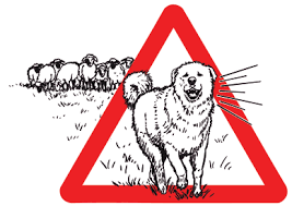
Pets allowed on leash only.
Period of practice
From 01/07 to 01/10.
Subject to favorable snow and weather conditions.
- Pets welcome
- Parking nearby
Contacts
Access
To get there by car: from Bramans, take the D100 towards Val d'Ambin and park in the Ambin parking lot.


