
This beautiful, mostly wooded route leads from the Chalet du Mélèze to the summit of La Chal and its cross. Overlooking the town of Saint-Jean-de-Maurienne and offering superb views over the whole valley, this is an ideal spot for a well-deserved picnic in the sunshine.
Variant :
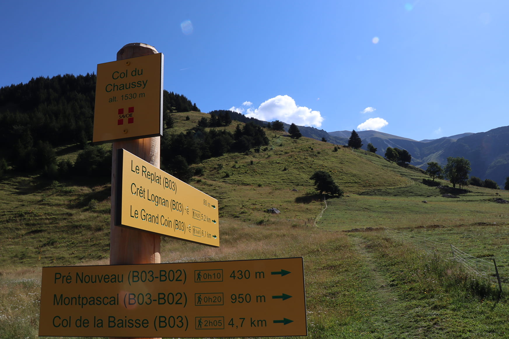
On the way back, 200 m after the Chalet du Mélèze, turn left into the meadow and head down towards Bergein. At the bend in the cross-country track, turn right and follow the Libertour stream to the Col du Chaussy: + 30 mins and + 65 m ascent compared with the original route.
What to see / What to know :
La Croix de la Chal is located on the summit of the Pointe de l'Armélaz mound (1840), which offers fine views of the Belledonne range, the Maurienne valley and the town of Saint-Jean-de-Maurienne, the Lauzière range, the Grand Coin, the Grand Perron etc.
Caution: herds of cattle may be on your path, so you'll need to go around the enclosure.
- Sport
La Chal
Join the most beautiful 360° panorama in the area. This beautiful itinerary, mostly in forest, overlooks the town of Saint-Jean-de-Maurienne and offers a superb view of the entire valley.
Sport La Chal La Tour-en-Maurienne
About

Further informations
Ground, Grit
Prices
Free access.
Reception
Dogs must be kept on a leash if herds are present.
Period of practice
From 15/04 to 15/11.
Subject to favorable weather.
Services
- Pets welcome
- Free car park
- Car park
Contacts
Access
- Not accessible in a wheelchair