All around you are vast meadows where sheep can be seen moving in the distance, in a white wave whose advance follows the movements of the relief.
When you reach Granges des Mottets, leave the track and follow the path up the mountainside. Look up and you'll surely spot vultures circling over the tapering ridges of the Massif des Cerces.
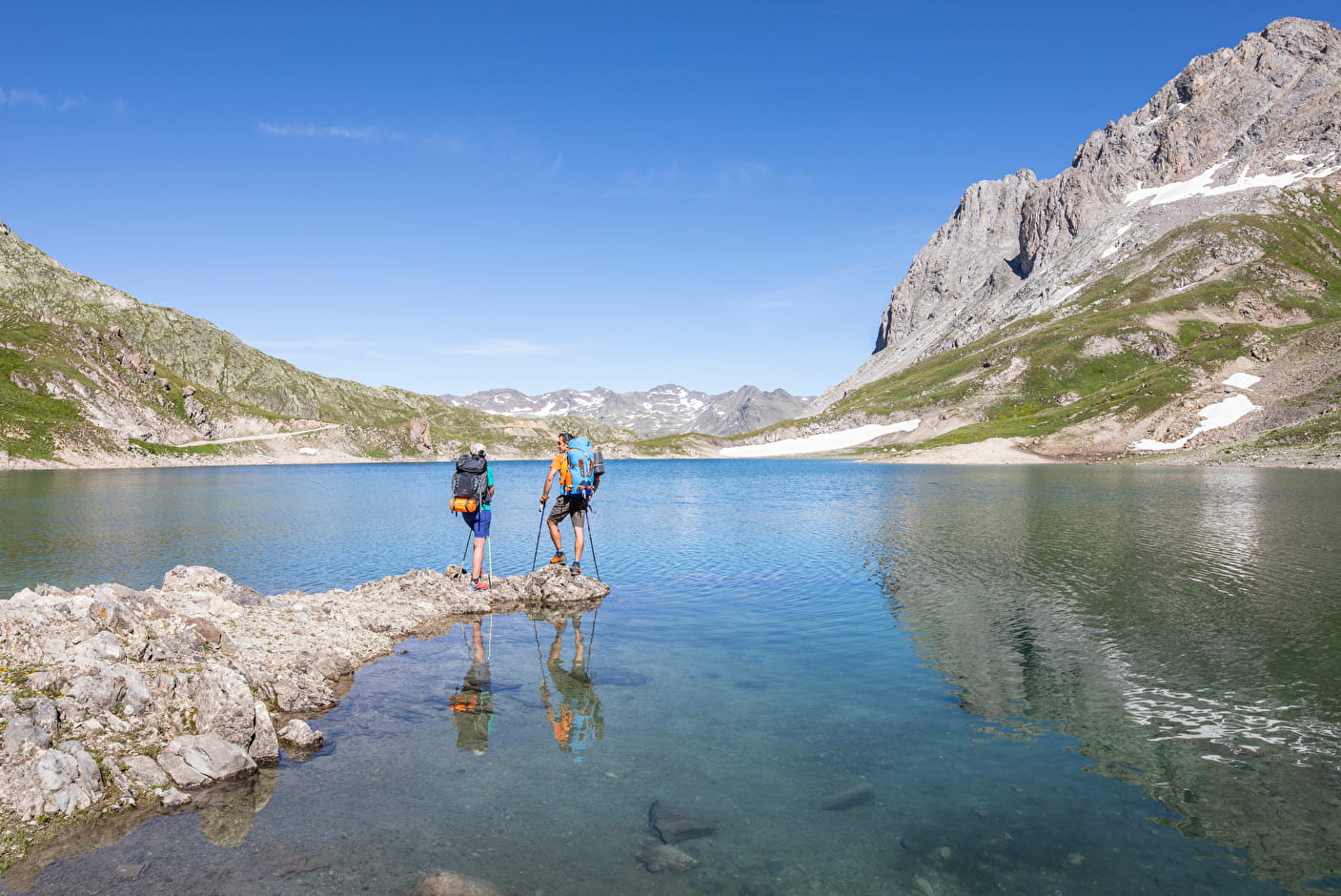
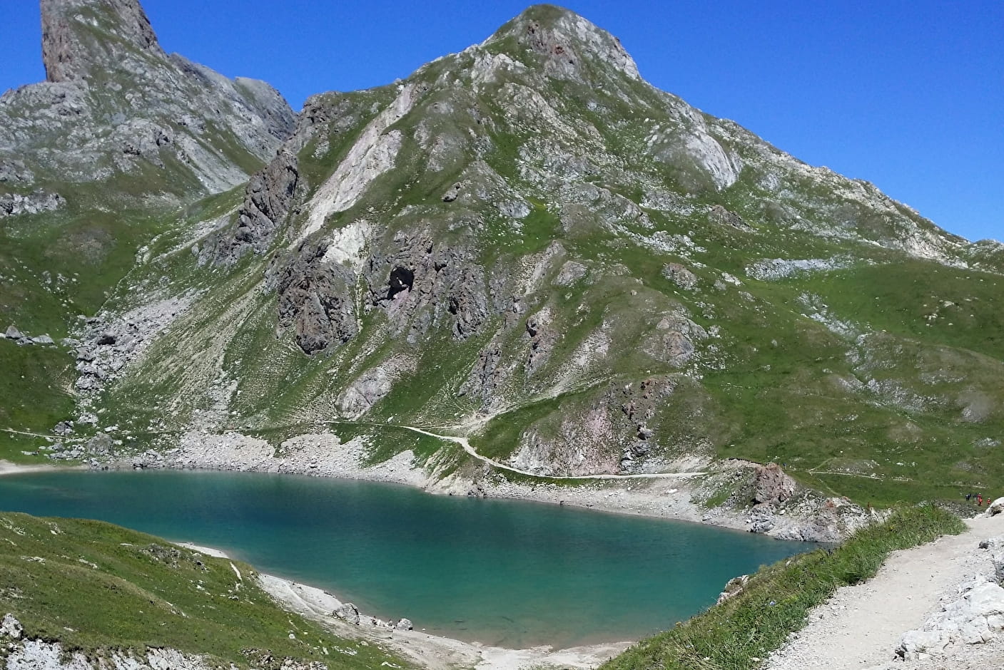
A little further on, Lac des Cerces appears, curled up in its stone nest. The blue of its waters, reflecting the clear sky, stands out against the charcoal grey of the rocks and the soft green of the grass. Take the time to pause here.
Further on, a second and then a third lake dot the trail, like pearls in a jewel.
After the Col des Rochilles, you'll discover a different atmosphere as you cross the military camp. Discover the Maginot works at Les Rochilles (1931/1940) and spend a night in the shoes of a soldier, sleeping in the building transformed into a refuge! To activate geolocation, click on the map icon.
- Sport
Les trois lacs - Hiking trail
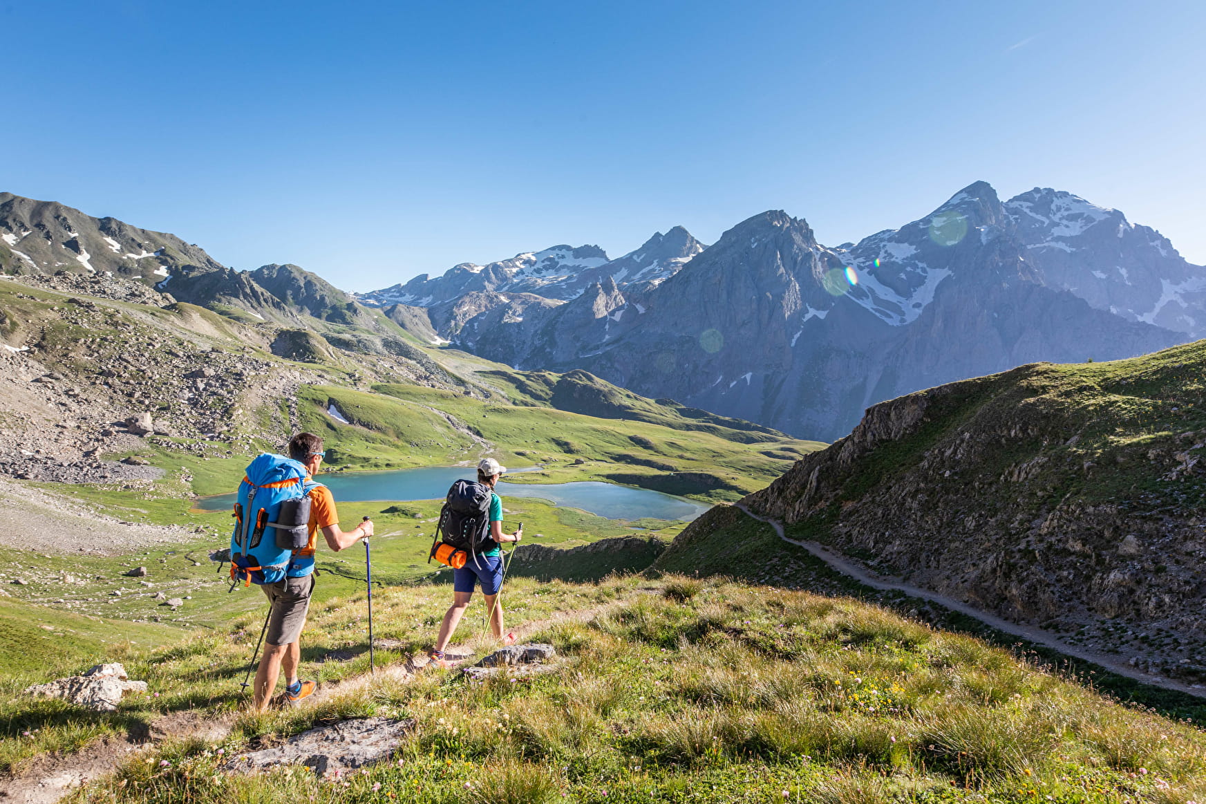
Below the Galibier, the jagged mountains of the Cerces are split by several passes that give access to the “département” of Les Hautes Alpes. The Lacs de Cerces are undoubtedly the brightest jewel in the area’s crown.
About

Map references
Map of Valloire hiking and mountain biking trails, on sale at the tourist office. IGN map 3435ET VALLOIRE - Aiguilles d'Arves / Col du Galibier is on sale in Valloire shops.
Topoguides references
Topoguide Savoie Mont Blanc on foot
Further informations
Rock, Stone, Ground, Grit


Start: From the Plan Lachat parking lot at 1980 m altitude, take the military trail to the Mottets barns.
1/ Take the path on the right towards Lac des Cerces.
2/ At the lake, turn left on the GR 57 towards the Col des Cerces. 3/ Once over the pass, the path descends between Lac Rond and Lac du Grand Ban.
4/ Skirt both lakes on the right, then continue towards the Col des Rochilles.
5/ At the Rochilles camp, join the Plan Lachat parking lot, descending along the hiking trail.
6/ Cross the small Jargette stream and continue down to Plan Lachat.
7/ At the end of the trail, follow the Mottet track to the Plan Lachat parking lot.
- Find out about weather conditions before you leave.
- This hike takes place in summer when there is no more snow.
- Inform someone of your itinerary, as communication may be limited.
- It's best to set off in the morning, so as not to be caught out at night, and let someone know if you're going on your own.
- The routes you take are your own responsibility.
- Choose an itinerary suited to your physical and technical ability. If in doubt, don't hesitate to contact mountain professionals.
- Make sure you're properly equipped to hike safely and cope with the vagaries of the weather. There are a few things you can do to make your experience safer and more enjoyable. Walking poles improve balance, and regular hydration is essential.
Carry a water bottle and snacks to keep your energy up. Protect yourself from the sun with sunscreen and sunglasses. Don't forget binoculars to add a touch of observation to your adventure.
Reception
To keep the mountains a pleasure, choose an activity suited to your level of experience and physical ability. Check the weather and seek advice from qualified professionals, and tell someone about your itinerary. Set off with the right equipment: good shoes and walking poles. In your rucksack, carry a water bottle and snacks to keep your energy levels up, a survival blanket or warm clothing. Protect yourself from the sun with sunscreen and sunglasses. Don't forget binoculars to add a touch of observation to your adventure.
Pets must be kept on a leash.
Period of practice
Throughout the year : open daily.
- Pets welcome
- Restaurant
- Car park
- Free car park
Contacts
Access
From Valloire, follow the Col du Galibier road for 8 km. Just before the last bridge over the River Valloirette, park on the left in the Plan Lachat car park.