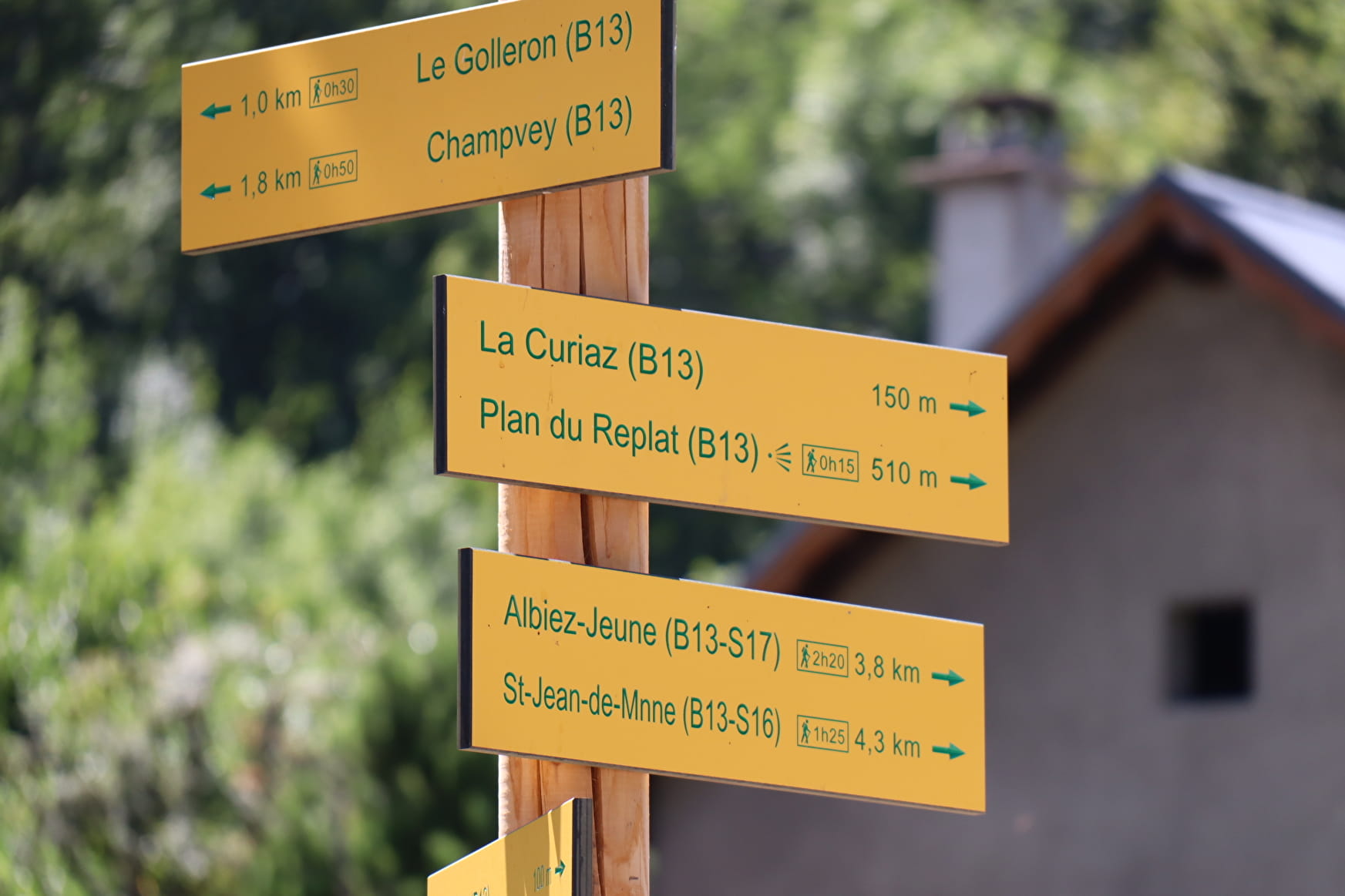
It is possible to reach the village of Albiez-le-Jeune by
continuing up the S17 path.
- Sport
Malpasset
Departing from Villargondran, this fairly accessible route offers panoramic views over the valley and the Vanoise massif... Entirely wooded, it's all the more enjoyable in hot summer weather.
Sport Malpasset Villargondran
About

Further informations
Ground
1 3


1/ Saint-Alban church:
At the church, cross the parking lot and climb the stairs opposite. Then turn left into the narrow streets of the Chef-lieu.
2/ Bourneau :
At the intersection with path L03, turn right up rue du Cochard for loop B13.
3/ La Vie Plaine :
At the crossroads, continue up the street towards the D80. After crossing the road, follow the path into the forest. You'll then begin the shady ascent through a magnificent beech forest.
4/ Le Golleron :
Turn right at the fork in the forest. The path becomes narrower in the beech forest (take care to follow the signs, as the path is not always well marked with the foliage on the ground).
5/ Champvey :
Turn right at the sign. The climb continues for another 300 m or so before reaching a forest track.
6/ La Balme:
Follow the forest track to the right, which runs flat over the beech forest for about 800 m.
7/ Mollarvoutiers :
At the intersection with the D80 road, in the bend, leave the track and descend onto the road for a few metres.
8/ Combe Villard:
Crossroads between the B13 loop and the S17 path (towards Albiez-le-Jeune). To continue on the B13, leave the road and turn right. From this point onwards, as far as the village of Villargondran, you descend into the forest, following the winding road.
9/ Le Villard :
At the bend in the road, take the path opposite. There's another 1 km or so of descent before the Plan du Replat lookout.
10/ Plan du Replat :
At the side of the road, this lookout offers a superb view of the valley floor and its heights, with an orientation table to help you read the landscape. To get back down to the village, take the path to the left of the road after the orientation table.
11/ Le Gourro :
At the intersection, take the right-hand path. For a quicker return to the parking lot, you can also take the left-hand path (S16 and L03).
12/ La Curiaz :
End of the path. Go up the road for a few metres, then turn left into rue de la Vie Plaine. Then go back down the rue du Cochard taken on the outward journey to return to the town hall parking lot and the Saint-Alban church.
Prices
Free access.
Reception
Period of practice
All year round.
Subject to favorable weather.
Services
- Pets welcome
- Free car park
- Car park
- Orientation board


