Pissieu Waterfall forms just downstream from a source into which most of the rainwater and snow-melt drains into off the Margériaz Plateau. It is created from a karst resurgence of water from the so-called "Vauclusian source"; i.e. the largest source of resurgence water in the whole of France. Beneath the entrance to the source, a submerged underground network plummets to a depth of 50 metres before making its way back up towards the Margériaz Plateau.
Up to now, 79km of underground networks have been identified under the Margériaz Plateau, including the 'Tanne du Cochon' network, which has an elevation difference of 825 metres between its starting point on the plateau and its resurgence at Le Pissieu.
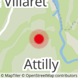
You can get to the waterfall either via the car park by the 'Pont sur le Nant d'Aillon' (bridge over the Nant d'Aillon river) on the road between the villages of Attilly and Le Villaret Rouge, via the swimming lake in Le Châtelard or via Les Iles du Chéran Outdoor Activities Centre car park. The itinerary passes close to the "Chèvrerie des Tannes et Glacières", a goat farm producing mohair.
Pissieu Fall
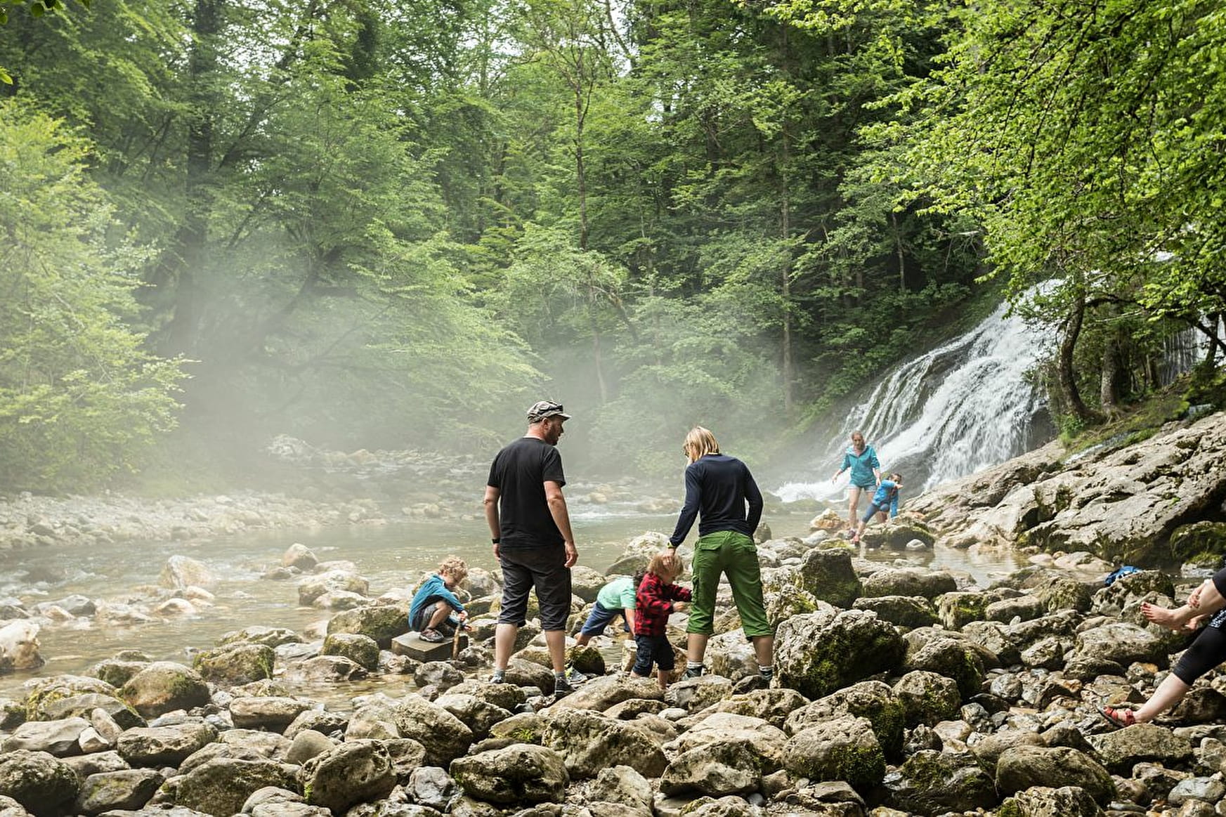
An easy and refreshing walk to the superb waterfall and its source. The site is accessible all year round and is particularly spectacular after periods of heavy rain or melting snow.
About

Signs
Yellow and green signposted route.
Map references
TOP 25 IGN 3432 OT, Bauges Massif
Further informations
Ground, Grit


Two other acesses : park at the Outdoor Activities Centre in Lescheraines and make your way up to the waterfall via the lakes and pathways alongside the Chéran river (1 hour more), or, you can also make your way up to the waterfall from the village centre in Le Châtelard by crossing over the Chéran river by the 'Picot' bridge.
You can continue the walk by following the source of the waterfall up the 'Savoyarde' discovery walk via Le Villaret, Rossillon and Les Iles du Chéran
Don't miss the other geosites to discover such as the 'Tannes et Glacières' trail and the Tanne du Névé / Porte Cochère caving hike.
More information on hiking routes can be found in the guidebook section
Reception
- Pets welcome

