

The start at the Châtelard bridge is already full of surprises. What's this unusual letterbox that marks the start of the climb? Inside, the objects are just waiting to be put into your rucksack and found by the guardians.
After a 700 m climb through the forest, you're welcomed by wide-open spaces. The verdant mountain pastures are a delight for ibex and chamois, enjoying the cool summer mornings. When you arrive at the Mont, remember to look up. Here, away from prying eyes, eagles, griffon vultures, turkey vultures and bearded vultures rule the skies. You never know
if they're watching you as you soar majestically in the thermals?
In the distance, the sun is already reflecting on the Arpont refuge. The traverse isn't over yet, but the gourmet break looks promising...
- Sport
The Arpont refuge
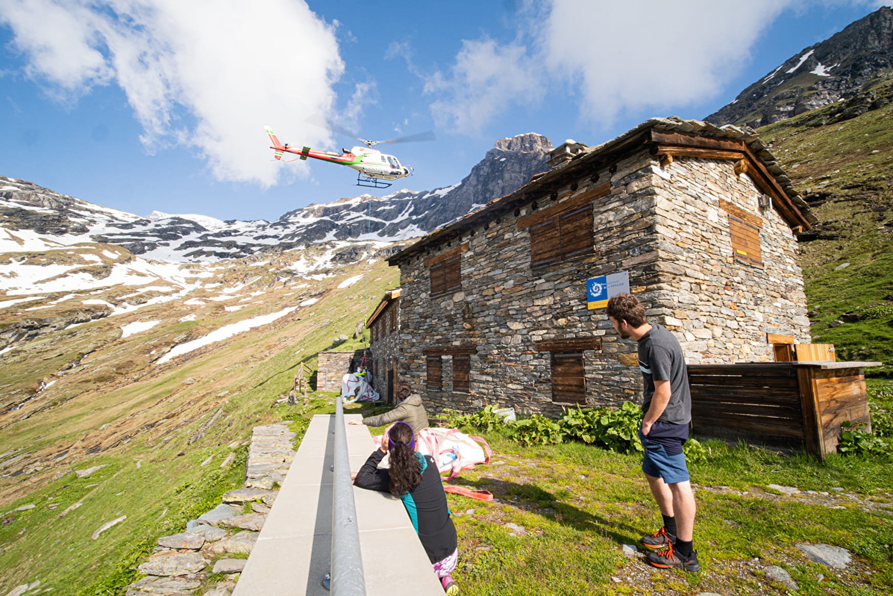
Take a day-long adventure on the GR5. You'll be able to enjoy a wide range of flavors all the way to the Arpont refuge, which promises a breathtaking change of scenery at the foot of the Dôme de Chasseforêt.

About
Signs
Mixed markings (PR, GR and PNV)
Map references
Map IGN 3634OT - Val Cenis Map IGN 3534OT - Les Trois Vallées
Topoguides references
Map and booklet "Haute Maurienne Vanoise. 115 walks and hikes - 35 trail routes. For all levels" (sold for €10 in Tourist Offices) - Itinéraire noir n°107
Further informations
Stone, Ground
To guide you in the field, consult the "step-by-step" directional diagram provided in pdf.
Prices
Free access.
Reception
The duration of hiking trails is calculated using reference paces: 300 m/h ascent, 500 m/h descent and 4 km/h on the flat.
As hazards may occur at any time on the routes, the GPX tracks provided are not contractual. They are given for information only. Riders use them at their own risk, depending on their level of technological proficiency and their understanding of the terrain.
Period of practice
From 15/04 to 15/10.
Subject to favorable snow and weather conditions.
- Parking nearby
Contacts
Access
The hike starts at the Chatelard bridge.
By car: from Termignon, take the RD83 to the Chatelard bridge.