


The scenery gradually grows more dramatic until the Rocheure torrent,
as you enter the popular Plan du Lac plateau. To your delight, you're accompanied by whistles of marmots, who seem quite tame. Your first glimpse of the Vanoise glaciers sparks your sense of adventure once again. From their heights of considerably more than 3,000 m, they seem to be keeping a close eye on you.
Transfixed by their presence, you now tackle on the slopes at the snow zone; momentarily, the ascent becomes challenging. It'll offer up an extraorinary landscape.
Getting to the glacial lakes of Lozières feels like plunging into a seemingly endless wilderness. Have a rest and enjoy the view over Pointe de Lanserlia. Who knows, perhaps chamois and ibex will join the fun?
- Sport
The Lozières Lakes
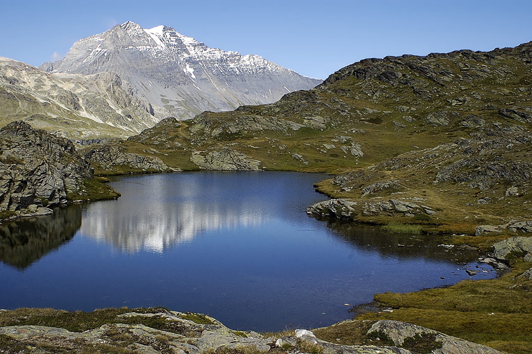
Get up close to the unspoilt glaciers in the one of Haute Maurienne Vanoise's paradises. This alpine hike takes you to the gates of the high mountain. With the proper footwear, you'll have no problems on the ascent and descent along the right bank of the Rocheure.
About
Signs
Vanoise National Park markings (PNV)
Map references
Map IGN 3633ET - Tignes Val-d'Isère Map IGN 3534OT - Les Trois Vallées
Topoguides references
Map and booklet "Haute Maurienne Vanoise. 115 walks and hikes - 35 trail routes. For all levels" (sold for €10 in Tourist Offices) - Itinéraire noir n°108
Further informations
Rock, Ground
To guide you in the field, consult the "step-by-step" directional diagram provided in pdf.
Prices
Free access.
Reception
The duration of hiking trails is calculated using reference paces: 300 m/h ascent, 500 m/h descent and 4 km/h on the flat.
As hazards may occur at any time on the routes, the GPX tracks provided are not contractual. They are given for information only. Riders use them at their own risk, depending on their level of technological proficiency and their understanding of the terrain.
Period of practice
From 01/07 to 01/10.
Subject to favorable snow and weather conditions.
- Parking nearby
Contacts
Access
By bus: Line 2 - stop at Parking de Bellecombe.
By car: park in the Bellecombe parking lot (charge July-August).