- Stage 3: Chalet du Perron -> Col du Mollard: 14.9 km / D+ 670 m / D- 1182 m
You pass close to the Aiguilles d'Arves at the Basse du Gerbier (2581 m).
Strictly below the "Tête de Chat" (3364 m). A mountain hike for regular walkers, but with no particular technical difficulties.
- Sport
Tour des Aiguilles d'Arves - Stage 3 - From Chalet du Perron to Col du Mollard
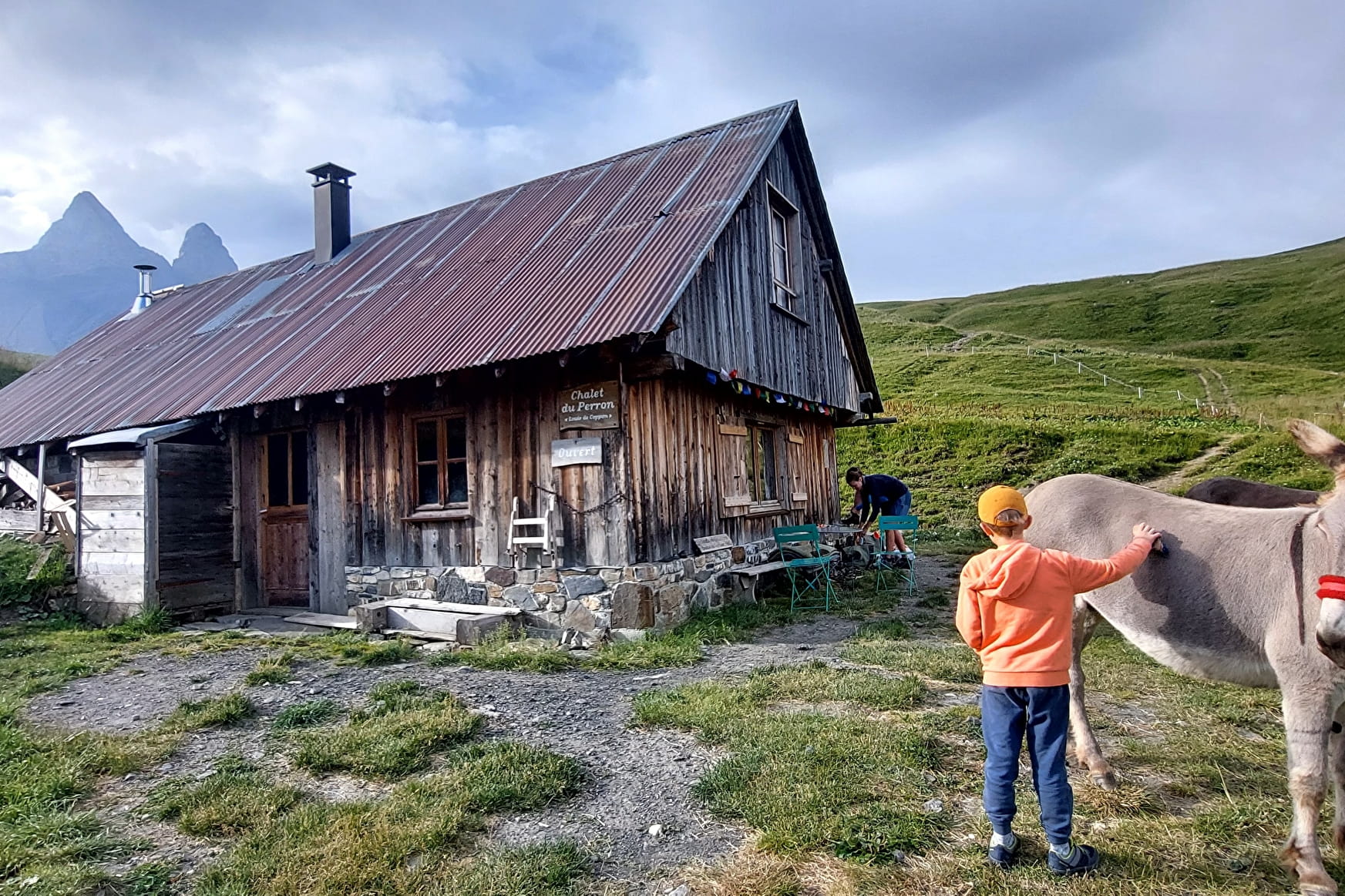
Venture to the foot of the mythical Aiguilles d'Arves. You'll find yourself in a picture-postcard setting, between mountain pastures and forests. Accessible to even inexperienced hikers, this promises to be an enchanting break!
Sport Tour des Aiguilles d'Arves - Stage 3 - From Chalet du Perron to Col du Mollard Albiez-Montrond
About

Further informations
Stone, Grit, Hard coating (tar, cement, flooring), Ground
We advise you to book accommodation well in advance, given its small capacity.
It is advisable to book accommodation well in advance, given its small capacity.
Recommended equipment :
- Mountain boots suitable for walking on varied terrain (rigid soles)
- Rain gear
- Warm clothing
- Pair of telescopic poles
- Cash (CB terminals not always available in refuges)
1/ Day 1: Col du Mollard -> Chalet d'la Croë 8 km / D+ 517 m / D- 81 m
From Col du Mollard, continue 100 m on the D80, turning slightly left onto Rue du Ravarin towards La Frédière.
At the Échaux chairlift, turn left onto Route de la Praz. Continue towards La Frédière.
At La Frédière, go back down to Rieu Gilbert, then up through the Sur la Broue chalet.
Rejoin the road, continue uphill, then turn left onto the path towards Les Chabottes.
At the signpost for Sur le Torrent, turn right onto the track.
Take the left-hand track to Chalet d'la Croë.
2/ DAY 2: Chalet d'la Croë -> Chalet du Perron : 8.3 km / D+ 536 m / D-463 m
Take the path south from Chalet d'la Croë to join the track at Bassin.
At La Motte turn left, leaving a chalet on your right, cross the stream and follow the ridge to Plan Pradin.
At Plan Pradin, turn slightly right towards Tête de Chat.
At the signpost below Tête de Chat, turn right and follow the ridge to Basse du Gerbier.
Turn left and follow the ridge after 2 zigzags to the La Crête point, continuing downhill to the Col.
From the Col, descend through the mountain pastures to the Chalet du Perron.
3/ DAY 3: Chalet du Perron -> Col du Mollard : 14.9 km / D+ 670 m / D- 1182 m
Prices
Free access.
Reception
Dogs must be kept on a leash due to the presence of herds.
Period of practice
From 20/06 to 22/09.
Services
- Pets welcome
- Free car park
- Car park
Contacts
Access
- Not accessible in a wheelchair