- Sport
Tour du Crêt du Rey trail
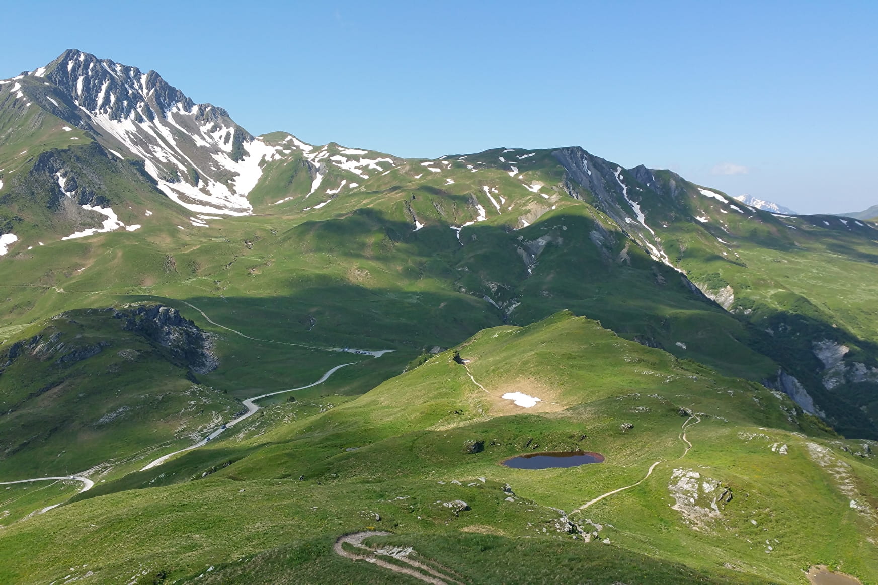
Panoramic view of the Beaufortain and Mont Blanc massifs.
About

Further informations
Rock, Stone, Ground
0/ Set off from Laval or Pré Jeune car parks.
1/ Take the direction of the Tour du Beaufortain, follow the track and the winding path to Col de la Pouprezaz.
2/ Go left and around La Raisse ridge towards Col de Corne Noire, then follow signs to "Tour du Crêt du Rey" .
3/ From Col de la Grande Combe follow the "Grand Tour de Tarentaise" signs and go back via La Coire refuge.
Prices
Free access.
Reception
FOR YOUR PLEASURE AND SAFETY
Safety rules
- Check the weather forecast before you leave.
- Avoid going alone. Let someone know that you are leaving and your planned route.
- Remember to drink, eat and take breaks throughout the hike.
Equipment
- Wear good shoes and suitable clothes for the mountains.
- Don't forget to take: sun cream, a hat/cap, sunglasses, warm clothes and rain wear, a mobile phone in case of problems.
- Take an IGN map with you. This map is given as an indication, it does not replace the IGN maps.
Best practices
- Stay on the marked paths and avoid the hayfields.
- Respect the environment.
- Watch out for animal herds, keep your dog on a lead.
- Take your rubbish away with you.
In case of accident: ring 112 or 18
Weather forecast: 32 50
Period of practice
From 01/05 to 15/11.
Subject to weather conditions.
- Pets welcome