DAY 1 : From Valmeinier to the Thabor refuge
- Start : 1 866 metres
- Summit: 2,787 metres
- Cumulative difference in altitude: 1 762 metres
At the top of the resort, go towards the jeux chairlift and take the path on the right indicating the Col des Marches (2725m).
Follow the stream of the Col des Marches which climbs slowly but surely. The Lac de Roche Noir (2564m) announces the approach of the Col.
Once over the pass, the lake of the Bissorte dam can be seen below.
Descend towards the Marches refuge (2230m).
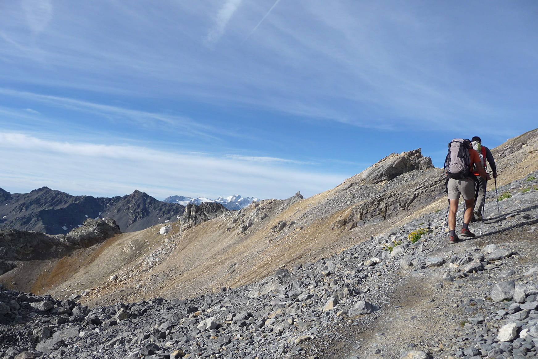
From there, follow the signs for the lake (2422m) and the Col des Bataillères (2787m). The path crosses postcard-like landscapes.
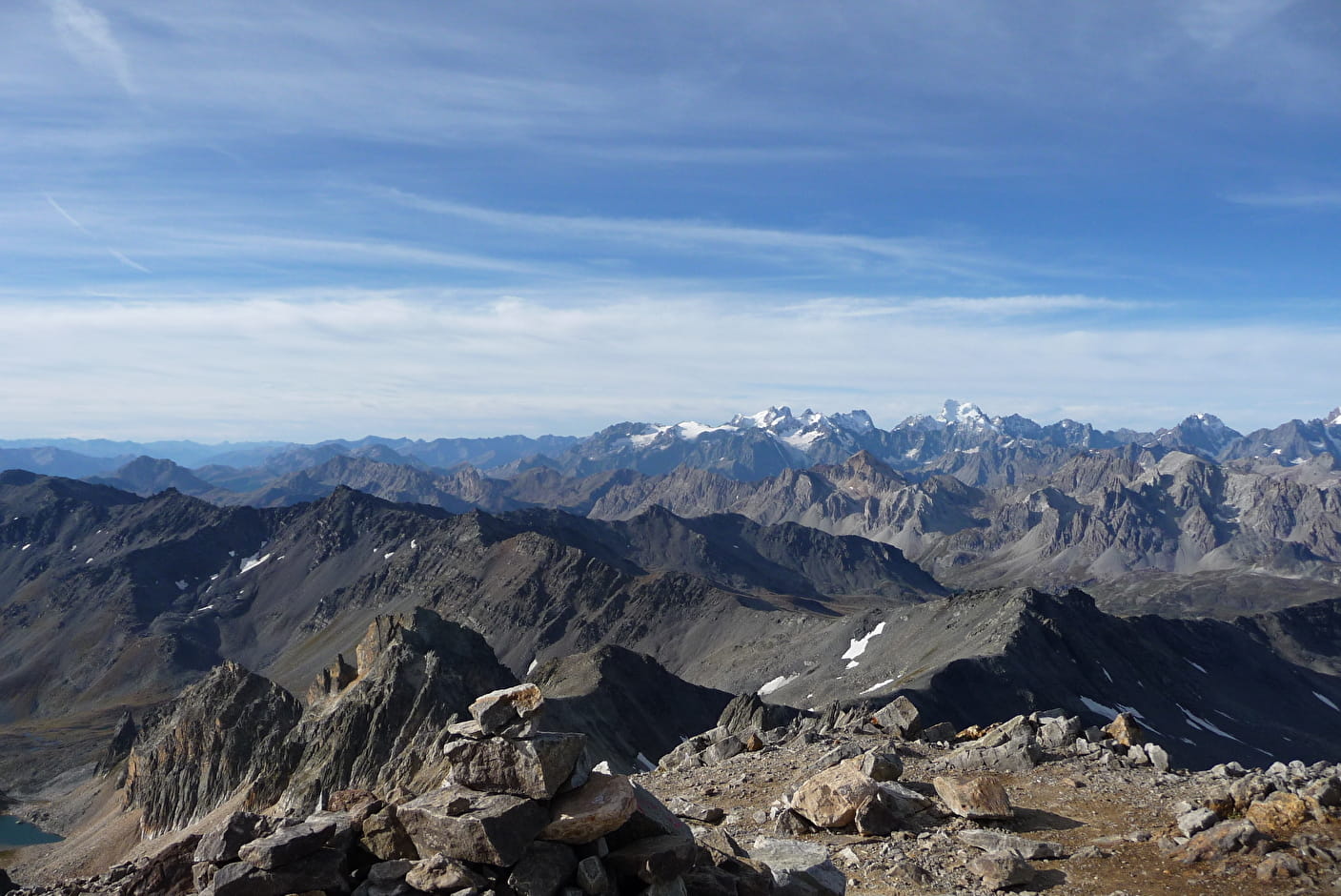
The pass offers beautiful views of the Cheval Blanc and Mont Thabor. Descend towards Lac Long and Lac Rond (Lacs Sainte Marguerite) located upstream from the Thabor refuge (2502m).
BIVOUAC near the refuge, on the edge of Lac Rond.
---
DAY 2 : From the Thabor refuge to the Drayères refuge
- Start: 2 502 metres
- Summit: 3 178 metres
- Cumulative difference in altitude: 900 metres
Departure from the Mont Thabor refuge (2502m). Head towards the Col de la Vallée Étroite (2434m).
Follow the path indicating the direction of Mont Thabor. After passing the Peyron lake (2453m), a nice steep path leads to the Chances du Peyron (2635m). The path then leads quietly to the Col des Méandes (2727m).
The Way of the Cross that leads to the chapel and then to the summit of Mont Thabor (3178m) is quite steep, but the view is worth it.
Go back down the path from the chapel to the small plateau (3060m). At the fork, take the path on the right (former GR of the Tour du Thabor).
The sloping path passes on the side of the Pointe des Angelières and leads to the Col de la Chapelle (2943m). Continue under the Roc de Valmeinier and reach the pass of the same name (2857m).
Follow the Roche du Chardonnet ridge (2950m). Be careful not to lose the track in the rocks! Look for the cairns. Finally, reach the Col des Muandes (2828m) which marks the former Franco-Savoy border, and descend towards the Drayères refuge (2180m). The path follows a very pleasant valley.
BIVOUAC near the refuge.
---
DAY 3 : From the Drayères refuge to Valmeinier
- Start: 2 180 metres
- Summit: 2 554 metres
- Total height gain: 915 metres
From the Drayères refuge (2180m), head towards the Clarée lake (2439m) and the Seuil des Rochilles (2459m).
Continue along the Lac Rond and at the Lac du Grand Ban, do not miss the path on the right that leads to the Col de la Plagnette (2525m).
Take the beautiful passage between the Aiguille Noire and the Rochers de La Grande Paré. About a kilometre and a half after the pass, at around 2250m, take the direction of the Pas des Griffes (2554m) which is reached after a long effort through a "cow mountain" (don't trust the sign which indicates Pas des Griffes at 4:00 am, 2 hours should be enough).
At the top, contemplate the landscape one last time before descending into the valley where the Neuvache flows. Follow Valmeinier 1800.
From Les Arendiers, the path along the stream is very pleasant until the Chenalette car park (1747m). Finally, follow Valmeinier 1900. A final steep climb takes you back to the starting point.
- Sport
Tour du Mont Thabor en 3 jours au départ de Valmeinier
Come to the end of the mythical Mount Thabor and its 3178 meters of altitude. On the programme: 3 days in the mountains, 2 nights in a bivouac, in sumptuous landscapes.
About

1 1

Prices
Free of charge.
Reception
Period of practice
From 15/05 to 15/10.
Subject to snow conditions.
Subject to favorable weather.
Contacts
Access
Park in the resort centre of Valmeinier.